
MyTopo
Indian Head Peak Nevada US Topo Map
Couldn't load pickup availability
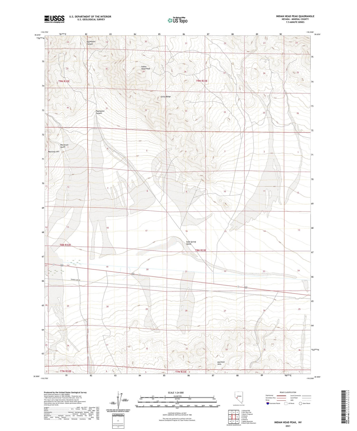
2021 topographic map quadrangle Indian Head Peak in the state of Nevada. Scale: 1:24000. Based on the newly updated USGS 7.5' US Topo map series, this map is in the following counties: Mineral. The map contains contour data, water features, and other items you are used to seeing on USGS maps, but also has updated roads and other features. This is the next generation of topographic maps. Printed on high-quality waterproof paper with UV fade-resistant inks.
Quads adjacent to this one:
West: Kinkaid
Northwest: Kinkaid NW
North: Win Wan Flat
Northeast: Mount Ferguson
East: Luning
Southeast: Black Dyke Mountain
South: Mable Mountain
Southwest: Pamlico
This map covers the same area as the classic USGS quad with code o38118e3.
Contains the following named places: Acme, Acme Tank, Blackrock Gulch, Copperfield, Copperfield Post Office, Fitting Mining District, Holiday Uranium Mine, Indian Head Peak, Paymaster Canyon, Silver King Mine


