MyTopo
Win Wan Flat Nevada US Topo Map
Couldn't load pickup availability
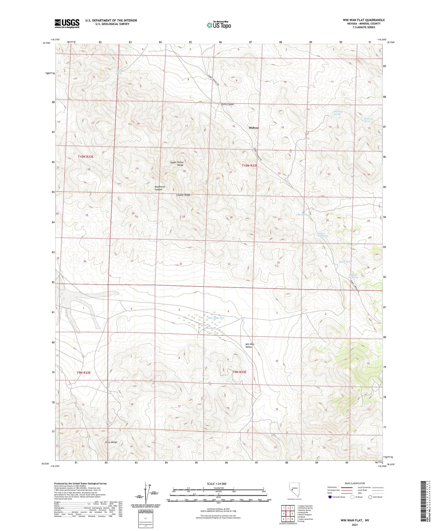
2021 topographic map quadrangle Win Wan Flat in the state of Nevada. Scale: 1:24000. Based on the newly updated USGS 7.5' US Topo map series, this map is in the following counties: Mineral. The map contains contour data, water features, and other items you are used to seeing on USGS maps, but also has updated roads and other features. This is the next generation of topographic maps. Printed on high-quality waterproof paper with UV fade-resistant inks.
Quads adjacent to this one:
West: Kinkaid NW
Northwest: Copper Mountain
North: Poinsettia Spring
Northeast: Ramsey Spring
East: Mount Ferguson
Southeast: Luning
South: Indian Head Peak
Southwest: Kinkaid
This map covers the same area as the classic USGS quad with code o38118f3.
Contains the following named places: Acme Copper Mine, Chukar Ridge, Dripping Vat Spring, Gillis Camp, Gillis Canon, Gillis Spring, Gillis Station, Martinez Spring, Midway, Rabbit Spring, Rabbit Spring Microwave Station, Sargent Well, Sargent Well Spring, Sargent Well Spring Holding Corral, Whiskey Spring, Wild Rose Spring, Win Wan Flat