MyTopo
Martin Canyon Nevada US Topo Map
Couldn't load pickup availability
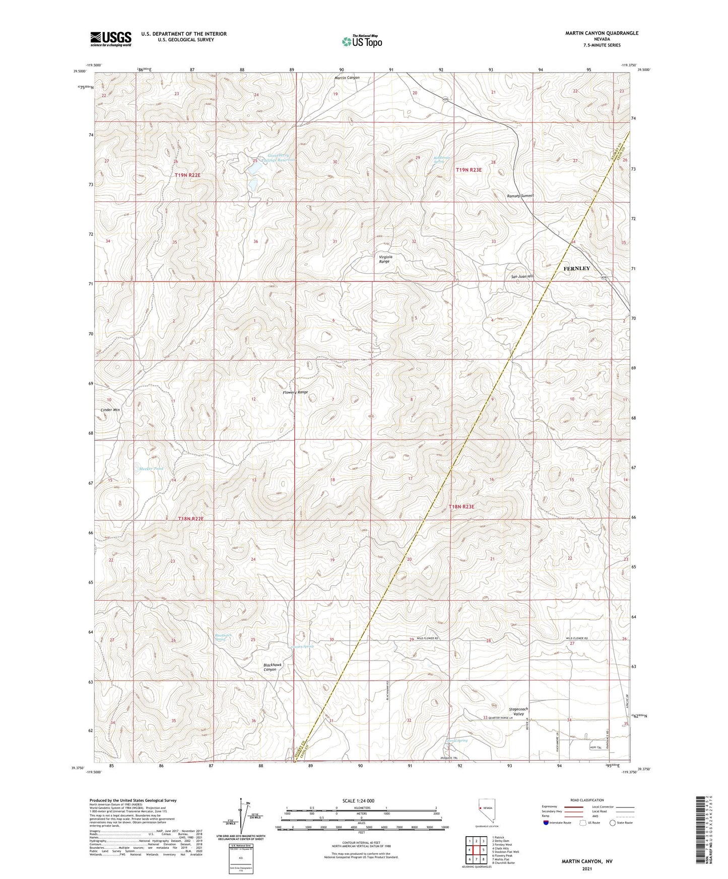
2021 topographic map quadrangle Martin Canyon in the state of Nevada. Scale: 1:24000. Based on the newly updated USGS 7.5' US Topo map series, this map is in the following counties: Storey, Lyon. The map contains contour data, water features, and other items you are used to seeing on USGS maps, but also has updated roads and other features. This is the next generation of topographic maps. Printed on high-quality waterproof paper with UV fade-resistant inks.
Quads adjacent to this one:
West: Chalk Hills
Northwest: Patrick
North: Derby Dam
Northeast: Fernley West
East: Stockton Flat Well
Southeast: Churchill Butte
South: Misfits Flat
Southwest: Flowery Peak
Contains the following named places: Biddleman Spring, Blackhawk Canyon, Blackhawk Mine, Blackhawk Spring, Cinder Mountain, Cinder Mountain Mine, Cooney Reservoir, Cooney Spring, Corral Spring, Goose Valley Mine, Gooseberry Mill, Gooseberry Mine, Gooseberry Mine Tailings Dam, Gooseberry Tailings Reservoir, Iron Mountain Mining District, Lizard Mine, Martin Canyon, Meeker Pond, Ramsey, Ramsey Mine, Ramsey Mining District, Ramsey Post Office, Ramsey Summit, Ramsey-Comstock Mine, San Juan Hill, San Juan Mine, Windy Day Mine