MyTopo
Fernley West Nevada US Topo Map
Couldn't load pickup availability
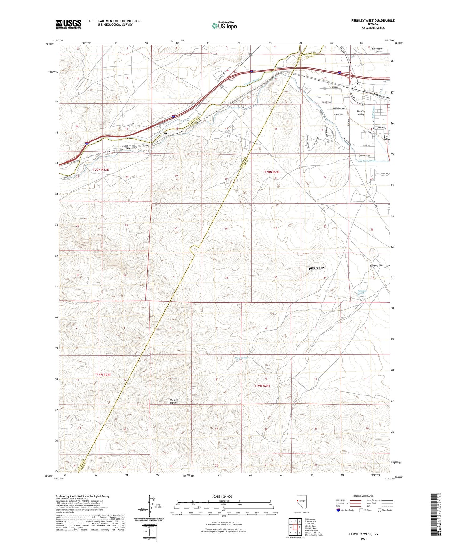
2021 topographic map quadrangle Fernley West in the state of Nevada. Scale: 1:24000. Based on the newly updated USGS 7.5' US Topo map series, this map is in the following counties: Lyon, Storey, Washoe. The map contains contour data, water features, and other items you are used to seeing on USGS maps, but also has updated roads and other features. This is the next generation of topographic maps. Printed on high-quality waterproof paper with UV fade-resistant inks.
Quads adjacent to this one:
West: Derby Dam
Northwest: Olinghouse
North: Wadsworth
Northeast: Two Tips
East: Fernley East
Southeast: Silver Springs North
South: Stockton Flat Well
Southwest: Martin Canyon
This map covers the same area as the classic USGS quad with code o39119e3.
Contains the following named places: Airway Beacon 212, Airway Beacon 216, Alexander Mine, Canal Township, Derby Tungsten Mine, Fernley, Fernley Valley, Freeman Spring, Gilpin, Gilpin Rest Stop, Horse Spring, Nevada Highway Patrol Northern Command West - Fernley Sunstation, Olinghouse Junction, Roderick, Roderick Post Office, Smith Ranch, Wadsworth Volunteer Fire Department