MyTopo
Lincoln Flat Nevada US Topo Map
Couldn't load pickup availability
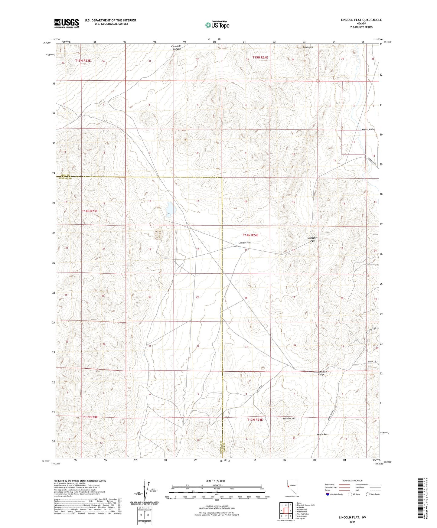
2021 topographic map quadrangle Lincoln Flat in the state of Nevada. Scale: 1:24000. Based on the newly updated USGS 7.5' US Topo map series, this map is in the following counties: Lyon, Douglas. The map contains contour data, water features, and other items you are used to seeing on USGS maps, but also has updated roads and other features. This is the next generation of topographic maps. Printed on high-quality waterproof paper with UV fade-resistant inks.
Quads adjacent to this one:
West: Mount Como
Northwest: Como
North: Churchill Canyon Well
Northeast: Wabuska
East: Mason Butte
Southeast: Yerington
South: Artesia Lake
Southwest: Pine Nut Valley
This map covers the same area as the classic USGS quad with code o39119a3.
Contains the following named places: Blackrock, Buckskin Mining District, Gallagher Pass, Guild Placer Mines, Lincoln Flat, Martha Washington Shaft, Mason Pass, McArthur Mine, Minnesota Mine, Sario Well, Singatse Range, Wishart Hill