MyTopo
McCullough Mountain Nevada US Topo Map
Couldn't load pickup availability
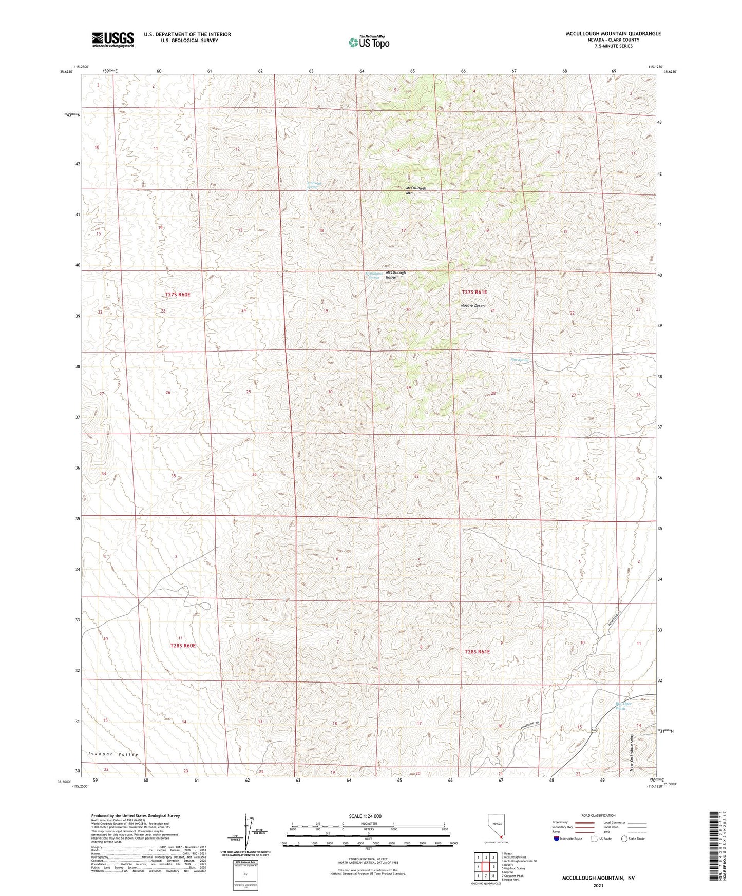
2021 topographic map quadrangle McCullough Mountain in the state of Nevada. Scale: 1:24000. Based on the newly updated USGS 7.5' US Topo map series, this map is in the following counties: Clark. The map contains contour data, water features, and other items you are used to seeing on USGS maps, but also has updated roads and other features. This is the next generation of topographic maps. Printed on high-quality waterproof paper with UV fade-resistant inks.
Quads adjacent to this one:
West: Desert
Northwest: Roach
North: McCullough Pass
Northeast: McCullough Mountain NE
East: Highland Spring
Southeast: Hopps Well
South: Crescent Peak
Southwest: Nipton
This map covers the same area as the classic USGS quad with code o35115e2.
Contains the following named places: Bird Spring, Cumberland Group Mine, Double Standard Mine, Lucky Dutchman Mine, McCullams Spring, McCullough Mountain, Pine Spring, Railroad Spring, Silver Bell Mine