MyTopo
Meeker Peak Nevada US Topo Map
Couldn't load pickup availability
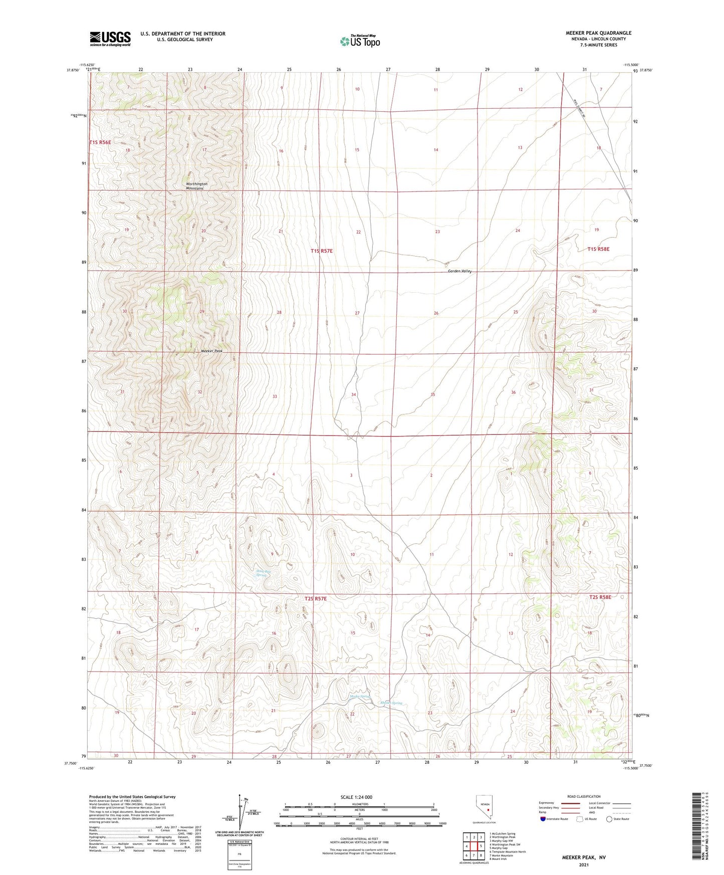
2021 topographic map quadrangle Meeker Peak in the state of Nevada. Scale: 1:24000. Based on the newly updated USGS 7.5' US Topo map series, this map is in the following counties: Lincoln. The map contains contour data, water features, and other items you are used to seeing on USGS maps, but also has updated roads and other features. This is the next generation of topographic maps. Printed on high-quality waterproof paper with UV fade-resistant inks.
Quads adjacent to this one:
West: Worthington Peak SW
Northwest: McCutchen Spring
North: Worthington Peak
Northeast: Murphy Gap NW
East: Murphy Gap
Southeast: Mount Irish
South: Monte Mountain
Southwest: Tempiute Mountain North
This map covers the same area as the classic USGS quad with code o37115g5.
Contains the following named places: Leviathan Cave Geologic Area, Meeker Peak, Modes Spring, Rhodes Spring, Rye Grass Well, Stink Bug Spring