MyTopo
Mount Irish Nevada US Topo Map
Couldn't load pickup availability
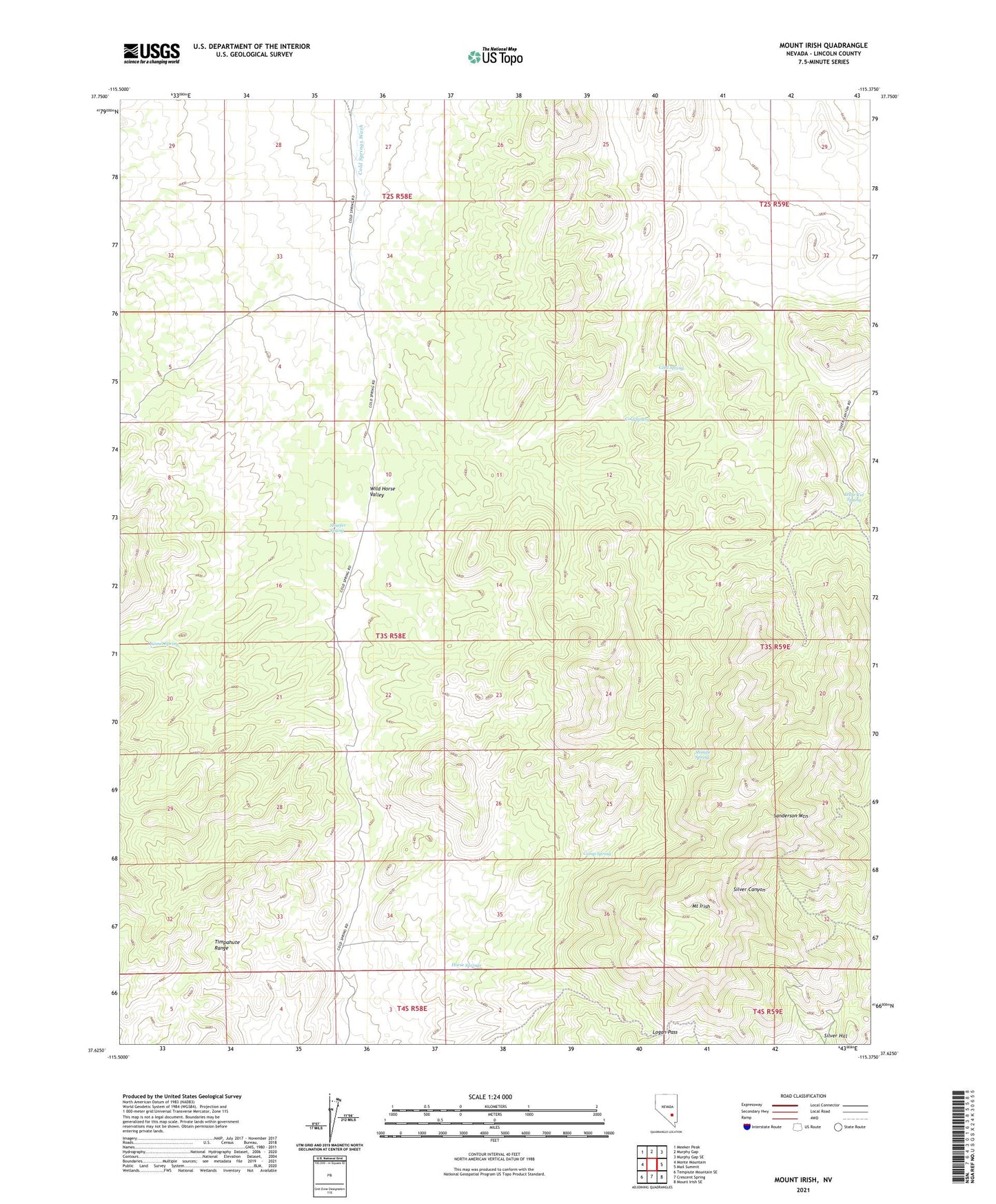
2021 topographic map quadrangle Mount Irish in the state of Nevada. Scale: 1:24000. Based on the newly updated USGS 7.5' US Topo map series, this map is in the following counties: Lincoln. The map contains contour data, water features, and other items you are used to seeing on USGS maps, but also has updated roads and other features. This is the next generation of topographic maps. Printed on high-quality waterproof paper with UV fade-resistant inks.
Quads adjacent to this one:
West: Monte Mountain
Northwest: Meeker Peak
North: Murphy Gap
Northeast: Murphy Gap SE
East: Mail Summit
Southeast: Mount Irish SE
South: Crescent Spring
Southwest: Tempiute Mountain SE
This map covers the same area as the classic USGS quad with code o37115f4.
Contains the following named places: Camp Spring, Cold Spring, Horse Springs, Little Cut Spring, Logan Pass, Mount Irish, Ora Lovell Mine, Pahranagat Mining District, Rosario Mine, Sanderson Mountain, Shaefer Spring, Shingle Spring, Silver Hill, Southpaw Mine, Tunnel Spring