MyTopo
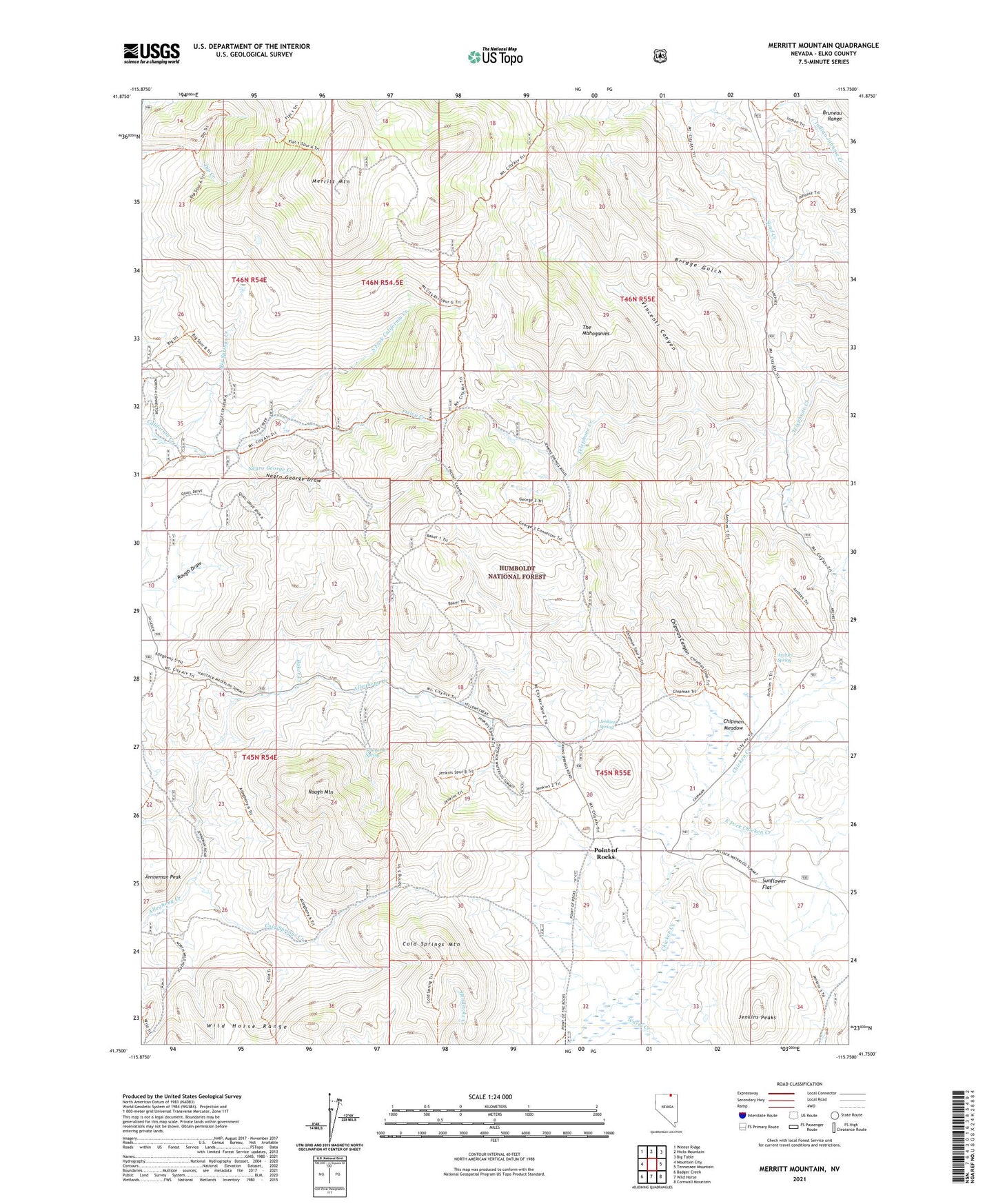
Merritt Mountain Nevada US Topo Map
Couldn't load pickup availability
Also explore the Merritt Mountain Forest Service Topo of this same quad for updated USFS data
2021 topographic map quadrangle Merritt Mountain in the state of Nevada. Scale: 1:24000. Based on the newly updated USGS 7.5' US Topo map series, this map is in the following counties: Elko. The map contains contour data, water features, and other items you are used to seeing on USGS maps, but also has updated roads and other features. This is the next generation of topographic maps. Printed on high-quality waterproof paper with UV fade-resistant inks.
Quads adjacent to this one:
West: Mountain City
Northwest: Winter Ridge
North: Hicks Mountain
Northeast: Big Table
East: Tennessee Mountain
Southeast: Cornwall Mountain
South: Wild Horse
Southwest: Badger Creek
This map covers the same area as the classic USGS quad with code o41115g7.
Contains the following named places: Archies Spring, Baker Creek, Big Springs Creek, Bridge Gulch, Chipman Canyon, Chipman Meadow, Cold Springs Creek, Cold Springs Mountain, East Fork Chicken Creek, Jenkins Peaks, Jenkins Spring, Jenneman Peak, Merritt Mountain, Negro George Creek, Negro George Draw, Pixley Creek, Point of Rocks, Rough Mountain, South Fork California Creek, Sunflower Flat, Transient Spring, Vincenti Canyon