MyTopo
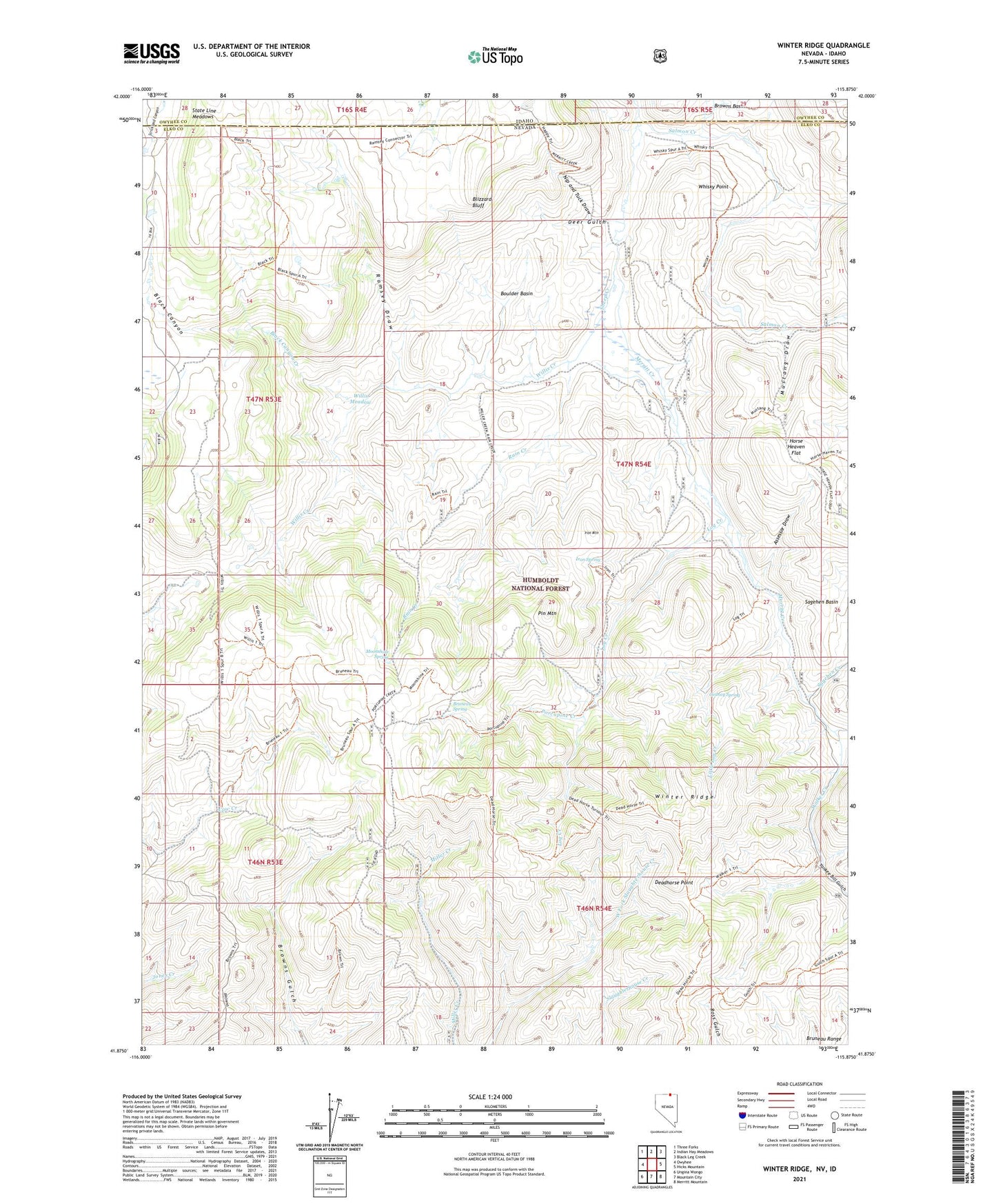
Winter Ridge Nevada US Topo Map
Couldn't load pickup availability
Also explore the Winter Ridge Forest Service Topo of this same quad for updated USFS data
2021 topographic map quadrangle Winter Ridge in the states of Idaho, Nevada. Scale: 1:24000. Based on the newly updated USGS 7.5' US Topo map series, this map is in the following counties: Elko, Owyhee. The map contains contour data, water features, and other items you are used to seeing on USGS maps, but also has updated roads and other features. This is the next generation of topographic maps. Printed on high-quality waterproof paper with UV fade-resistant inks.
Quads adjacent to this one:
West: Owyhee
Northwest: Three Forks
North: Indian Hay Meadows
Northeast: Black Leg Creek
East: Hicks Mountain
Southeast: Merritt Mountain
South: Mountain City
Southwest: Ungina Wongo
This map covers the same area as the classic USGS quad with code o41115h8.
Contains the following named places: Assessor Draw, Black Canyon, Black Canyon Creek, Blizzard Bluff, Boulder Basin, Bruneau Spring, Deadhorse Point, Deer Gulch, Gedney Spring, Happy Home Place, Horse Heaven Flat, Iron Mountain, Iron Spring, Kunz Ranch, Little Log Creek, Little Salmon Creek, Log Creek, Merritt Creek, Moonshine Spring, Mustang Draw, Nip and Tuck Draw, Pin Mountain, Porcupine Creek, Rain Creek, Ramsey Draw, Sagehen Creek, Salmon Creek, State Line Meadows, Walker Creek, Whisky Point, Willis Creek, Willis Meadow, Winter Ridge, Yankee Bill Gulch