MyTopo
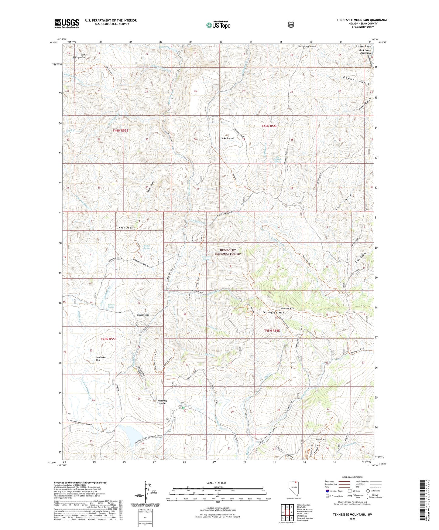
Tennessee Mountain Nevada US Topo Map
Couldn't load pickup availability
Also explore the Tennessee Mountain Forest Service Topo of this same quad for updated USFS data
2021 topographic map quadrangle Tennessee Mountain in the state of Nevada. Scale: 1:24000. Based on the newly updated USGS 7.5' US Topo map series, this map is in the following counties: Elko. The map contains contour data, water features, and other items you are used to seeing on USGS maps, but also has updated roads and other features. This is the next generation of topographic maps. Printed on high-quality waterproof paper with UV fade-resistant inks.
Quads adjacent to this one:
West: Merritt Mountain
Northwest: Hicks Mountain
North: Big Table
Northeast: Bearpaw Mountain
East: Coon Creek
Southeast: Annie Creek
South: Cornwall Mountain
Southwest: Wild Horse
This map covers the same area as the classic USGS quad with code o41115g6.
Contains the following named places: Alder Mining District, Bieroth Slide, Bieroth Spring, Big Bend Campground, Big Coffeepot Spring, Bristol Spring, Burnt Timber Creek, Diamond Jim Mine, Gold Creek Ranger Station, Hicks Summit, Indian Johnnie Creek, Keas Canyon, Keas Peak, Lime Creek, Little Telephone Creek, Martin Canyon, McMahan Ranch, Meadow Creek School, Mill Creek, Moonshine Gulch, Parks Cabin, Rosebud Mountain, Sand Creek, Slate Creek, Sunflower Dam, Sunflower Reservoir, Taylor Creek, Telephone Creek, Tennell Creek, Tennessee Creek, Tennessee Gulch, Tennessee Mountain, Tennessee Spring, The Mahoganies, Waterlog Summit, Wildhorse Mine