MyTopo
Midas Nevada US Topo Map
Couldn't load pickup availability
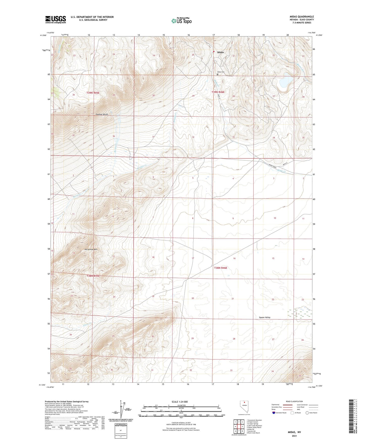
2023 topographic map quadrangle Midas in the state of Nevada. Scale: 1:24000. Based on the newly updated USGS 7.5' US Topo map series, this map is in the following counties: Elko. The map contains contour data, water features, and other items you are used to seeing on USGS maps, but also has updated roads and other features. This is the next generation of topographic maps. Printed on high-quality waterproof paper with UV fade-resistant inks.
Quads adjacent to this one:
West: Jake Creek Mountain
Northwest: Snowstorm Mountain
North: Oregon Canyon
Northeast: Scraper Springs
East: Squaw Valley Ranch
Southeast: Rock Creek Ranch
South: Sixmile Hill
Southwest: Midas SW
This map covers the same area as the classic USGS quad with code o41116b7.
Contains the following named places: Acme G Mine, Box Canyon Reservoir, Esmeralda Group, Esmeralda Mine, Fairlawn, Fairlawn Post Office, Gold Circle Mine, Gold Circle Mining District, Gold Crown Mine, Horseshoe Mountain, Jackson Mine, Link Mine, Midas, Midas Cemetery, Midas Mine, Midas Post Office, Midas Volunteer Fire Department, Rex Mill, Rex Mine, Saint Paul Mine, Spring Creek, Summit, Summit Creek, Summit Post Office, Wilkinson Ranch