MyTopo
Squaw Valley Ranch Nevada US Topo Map
Couldn't load pickup availability
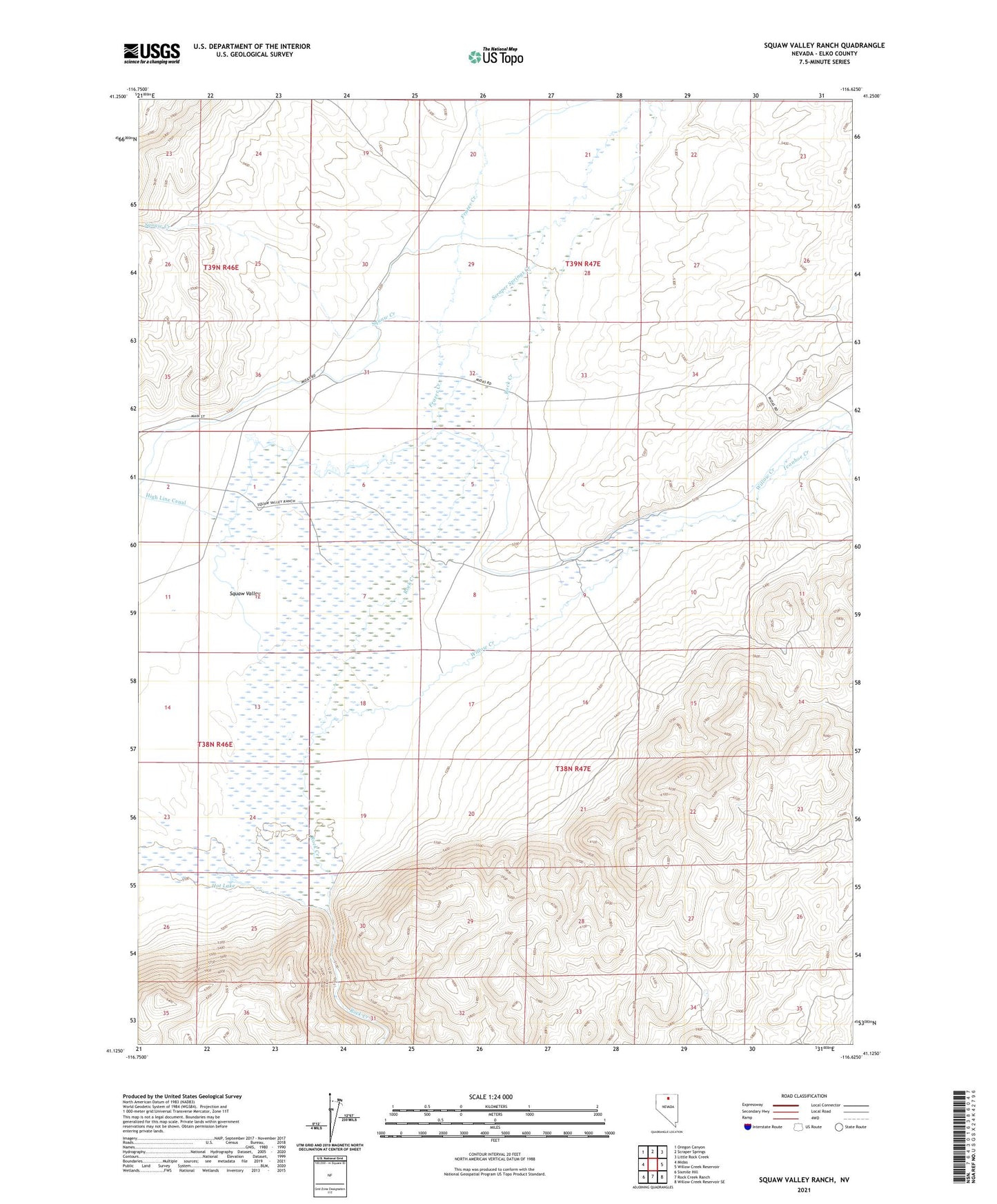
2023 topographic map quadrangle Squaw Valley Ranch in the state of Nevada. Scale: 1:24000. Based on the newly updated USGS 7.5' US Topo map series, this map is in the following counties: Elko. The map contains contour data, water features, and other items you are used to seeing on USGS maps, but also has updated roads and other features. This is the next generation of topographic maps. Printed on high-quality waterproof paper with UV fade-resistant inks.
Quads adjacent to this one:
West: Midas
Northwest: Oregon Canyon
North: Scraper Springs
Northeast: Little Rock Creek
East: Willow Creek Reservoir
Southeast: Willow Creek Reservoir SE
South: Rock Creek Ranch
Southwest: Sixmile Hill
This map covers the same area as the classic USGS quad with code o41116b6.
Contains the following named places: Dutton, Dutton Post Office, Frazer Creek, High Line Canal, Hot Lake, Ivanhoe Creek, Midas Creek, Scraper Springs Creek, Sheep Corral Mine, Squaw Creek, Squaw Valley, Squaw Valley Ranch, Willow Creek