MyTopo
Minerva Nevada US Topo Map
Couldn't load pickup availability
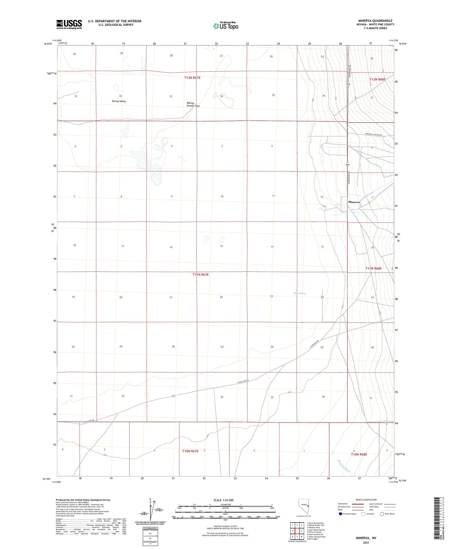
2021 topographic map quadrangle Minerva in the state of Nevada. Scale: 1:24000. Based on the newly updated USGS 7.5' US Topo map series, this map is in the following counties: White Pine. The map contains contour data, water features, and other items you are used to seeing on USGS maps, but also has updated roads and other features. This is the next generation of topographic maps. Printed on high-quality waterproof paper with UV fade-resistant inks.
Quads adjacent to this one:
West: Lake Valley Summit
Northwest: North Spring Point
North: Baking Powder Flat
Northeast: Wheeler Peak
East: Minerva Canyon
Southeast: Red Ledges
South: Indian Springs Knolls
Southwest: Mount Grafton NE
This map covers the same area as the classic USGS quad with code o38114g4.
Contains the following named places: Baking Powder Flat, Blind Spring, Consolidated School Number 2, Dry Lakes, Minerva, Shoshone, Shoshone Post Office, Swallow Ranch