MyTopo
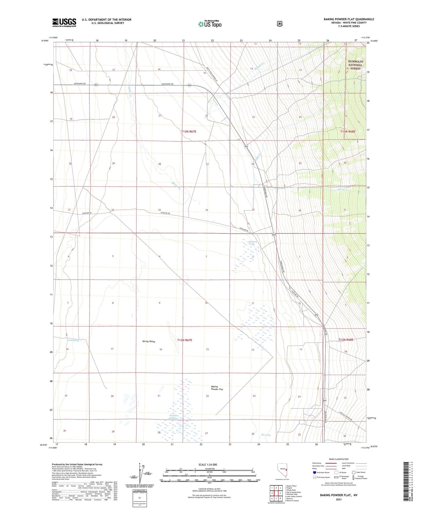
Baking Powder Flat Nevada US Topo Map
Couldn't load pickup availability
Also explore the Baking Powder Flat Forest Service Topo of this same quad for updated USFS data
2021 topographic map quadrangle Baking Powder Flat in the state of Nevada. Scale: 1:24000. Based on the newly updated USGS 7.5' US Topo map series, this map is in the following counties: White Pine. The map contains contour data, water features, and other items you are used to seeing on USGS maps, but also has updated roads and other features. This is the next generation of topographic maps. Printed on high-quality waterproof paper with UV fade-resistant inks.
Quads adjacent to this one:
West: North Spring Point
Northwest: Majors Place
North: Hogum
Northeast: Windy Peak
East: Wheeler Peak
Southeast: Minerva Canyon
South: Minerva
Southwest: Lake Valley Summit
This map covers the same area as the classic USGS quad with code o38114h4.
Contains the following named places: Cement Pipe Factory, Doyles Well, Floyd Smith Ranch, Harbecke Ranch, Kerr Ranch, Kirkeby Ranch, Kirkeby Ranch Airport, North Spring, Ridge Creek, Robinson Ranch, Scottys Meadow, Shingle Creek, Shoshone Ponds, Spring Creek, The Cedars, The Seep, Worthington Spring, Yelland Ranch, Yelton Ranch, Ziege Ranch