MyTopo
Wheeler Peak Nevada US Topo Map
Couldn't load pickup availability
Also explore the Wheeler Peak Forest Service Topo of this same quad for updated USFS data
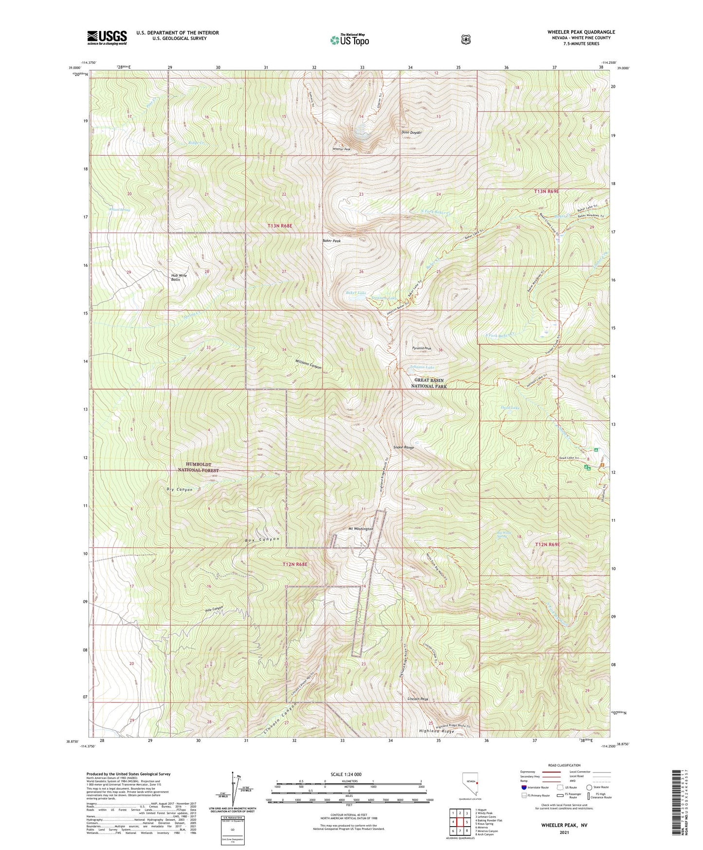
2021 topographic map quadrangle Wheeler Peak in the state of Nevada. Scale: 1:24000. Based on the newly updated USGS 7.5' US Topo map series, this map is in the following counties: White Pine. The map contains contour data, water features, and other items you are used to seeing on USGS maps, but also has updated roads and other features. This is the next generation of topographic maps. Printed on high-quality waterproof paper with UV fade-resistant inks.
Quads adjacent to this one:
West: Baking Powder Flat
Northwest: Hogum
North: Windy Peak
Northeast: Lehman Caves
East: Kious Spring
Southeast: Arch Canyon
South: Minerva Canyon
Southwest: Minerva
This map covers the same area as the classic USGS quad with code o38114h3.
Contains the following named places: Baker Lake, Baker Peak, Baker Shoshone Trail, Big Wash Spring, Box Canyon, Bristlecone Pine Interpretive Trail, Dead Lake, Doso Doyabi, Dry Canyon, Great Basin National Park, Highland Ridge, Hub Mine, Hub Mine Basin, Johnson Lake, Johnson Mine, Lincoln Peak, Mount Washington, Mount Washington Mining District, Mount Wheeler Mine, North Fork Baker Creek, Pine Creek, Pole Canyon, Pyramid Peak, Raised Spring, Saint Lawrence Mine, Shoshone Campground, Treasure Lake, Tungsten Mines Post Office, Tungsten Mining District, Wheeler Peak, Wheeler Peak Scenic Area, Williams Canyon