MyTopo
Montello Nevada US Topo Map
Couldn't load pickup availability
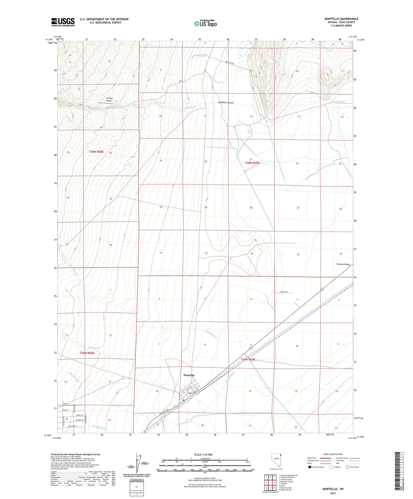
2021 topographic map quadrangle Montello in the state of Nevada. Scale: 1:24000. Based on the newly updated USGS 7.5' US Topo map series, this map is in the following counties: Elko. The map contains contour data, water features, and other items you are used to seeing on USGS maps, but also has updated roads and other features. This is the next generation of topographic maps. Printed on high-quality waterproof paper with UV fade-resistant inks.
Quads adjacent to this one:
West: Montello Canyon
Northwest: Ninemile Mountain NE
North: Twelvemile Ranch
Northeast: Jackson Spring
East: Tecoma
Southeast: Patterson Pass
South: Pilot Peak NW
Southwest: Loray
This map covers the same area as the classic USGS quad with code o41114c2.
Contains the following named places: Akbar, Charley Creek, Gamble Canyon, Gamble Creek, Gamble Ranch, Gamble Ranch Landing Strip, Gamble Spring, Gamble Well, Hoppie Creek, Juniper Airport, Montello, Montello Census Designated Place, Montello Creek, Montello Elementary School, Montello Landing Strip, Montello Post Office, Tecoma Township Volunteer Fire Department, Warm Springs