MyTopo
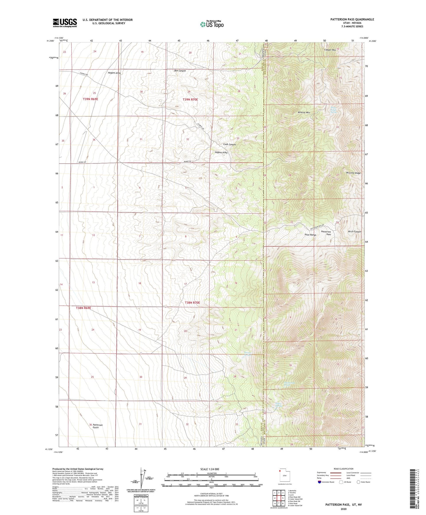
Patterson Pass Utah US Topo Map
Couldn't load pickup availability
2023 topographic map quadrangle Patterson Pass in the states of Nevada, Utah. Scale: 1:24000. Based on the newly updated USGS 7.5' US Topo map series, this map is in the following counties: Box Elder, Elko. The map contains contour data, water features, and other items you are used to seeing on USGS maps, but also has updated roads and other features. This is the next generation of topographic maps. Printed on high-quality waterproof paper with UV fade-resistant inks.
Quads adjacent to this one:
West: Pilot Peak NW
Northwest: Montello
North: Tecoma
Northeast: Lucin
East: Crater Island NW
Southeast: Crater Island SW
South: Pilot Peak
Southwest: Pilot Peak SW
This map covers the same area as the classic USGS quad with code o41114b1.
Contains the following named places: Box Canyon, Cook Canyon, Copper Mountain, Cottonwood Springs, Hogans Alley, Killian Springs, McGinty Ridge, Mineral Mountain, Parson Springs, Patterson Gulch, Patterson Pass, Sheep Range Spring