MyTopo
Tecoma Nevada US Topo Map
Couldn't load pickup availability
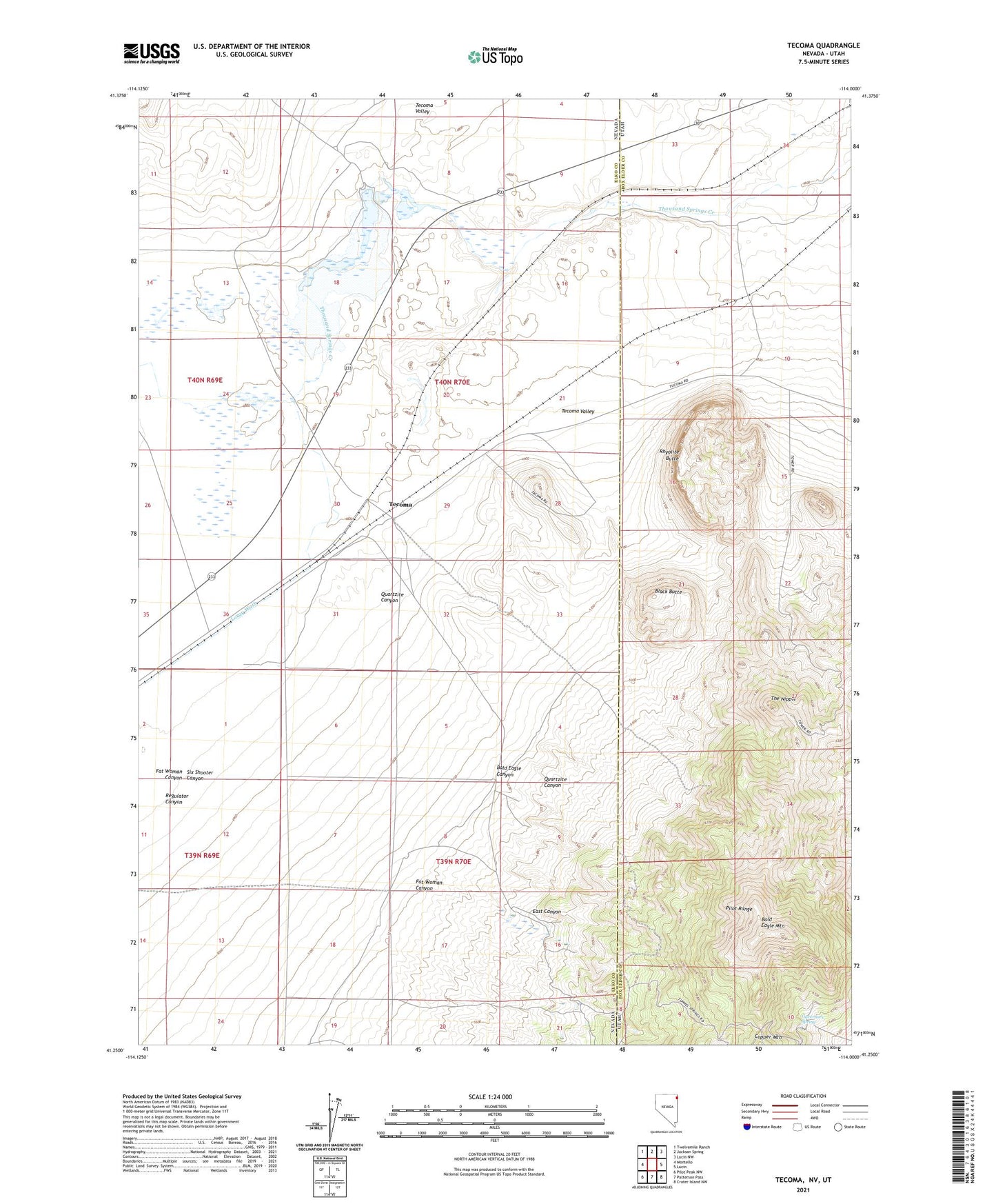
2021 topographic map quadrangle Tecoma in the states of Nevada, Utah. Scale: 1:24000. Based on the newly updated USGS 7.5' US Topo map series, this map is in the following counties: Elko, Box Elder. The map contains contour data, water features, and other items you are used to seeing on USGS maps, but also has updated roads and other features. This is the next generation of topographic maps. Printed on high-quality waterproof paper with UV fade-resistant inks.
Quads adjacent to this one:
West: Montello
Northwest: Twelvemile Ranch
North: Jackson Spring
Northeast: Lucin NW
East: Lucin
Southeast: Crater Island NW
South: Patterson Pass
Southwest: Pilot Peak NW
Contains the following named places: Bald Eagle Canyon, Bald Eagle Mountain, Black Butte, Buel Post Office, Buell, Dake Reservoir, Dake Reservoir Dam, East Canyon, Fat Woman Canyon, Governors Spring, Grouse, Jackson Dam, Jackson Siding, Loray Wash, Lucin Mining District, Pearson Ranch, Quartzite Canyon, Regulator Canyon, Rhyolite Butte, Six Shooter Canyon, Stockberger Well, Tecoma, Tecoma Post Office, The Nipple, Tuttle