MyTopo
Mount Airy Nevada US Topo Map
Couldn't load pickup availability
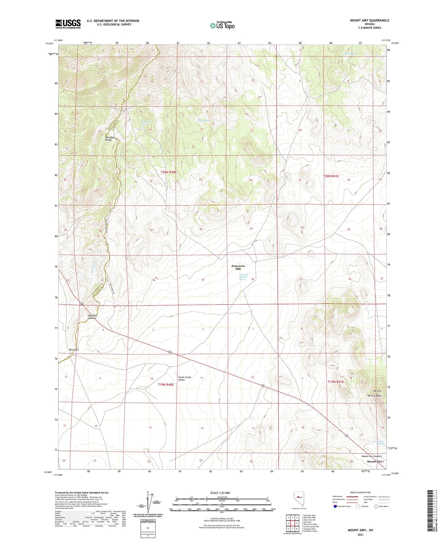
2021 topographic map quadrangle Mount Airy in the state of Nevada. Scale: 1:24000. Based on the newly updated USGS 7.5' US Topo map series, this map is in the following counties: Lander, Churchill. The map contains contour data, water features, and other items you are used to seeing on USGS maps, but also has updated roads and other features. This is the next generation of topographic maps. Printed on high-quality waterproof paper with UV fade-resistant inks.
Quads adjacent to this one:
West: New Pass
Northwest: New Pass Well
North: New Pass Peak
Northeast: Mount Airy NE
East: Mount Airy Mesa
Southeast: Gandolfo Canyon
South: Emigrant Peak
Southwest: Carroll Summit NE
This map covers the same area as the classic USGS quad with code o39117e4.
Contains the following named places: Barrel Spring, Gold Belt Shaft, Happy Days Mine, Indian Spring, Iron Tank Spring, Last Chance Mine, Little Jumbo Mine, Mount Airy, Mount Airy Mesa, Mount Airy Spring, Mount Airy Summit, Nevada Austin Mine, New Pass Mine, New Pass Summit, Newpass, Newpass Post Office, Newpass Ranch, Petersons Mill, Petersons Mill Hot Spring, Rabbit Foot Mine, Sheridan Mine, Superoir Shaft, Thomas W Shaft, Yellow Bull Mine