MyTopo
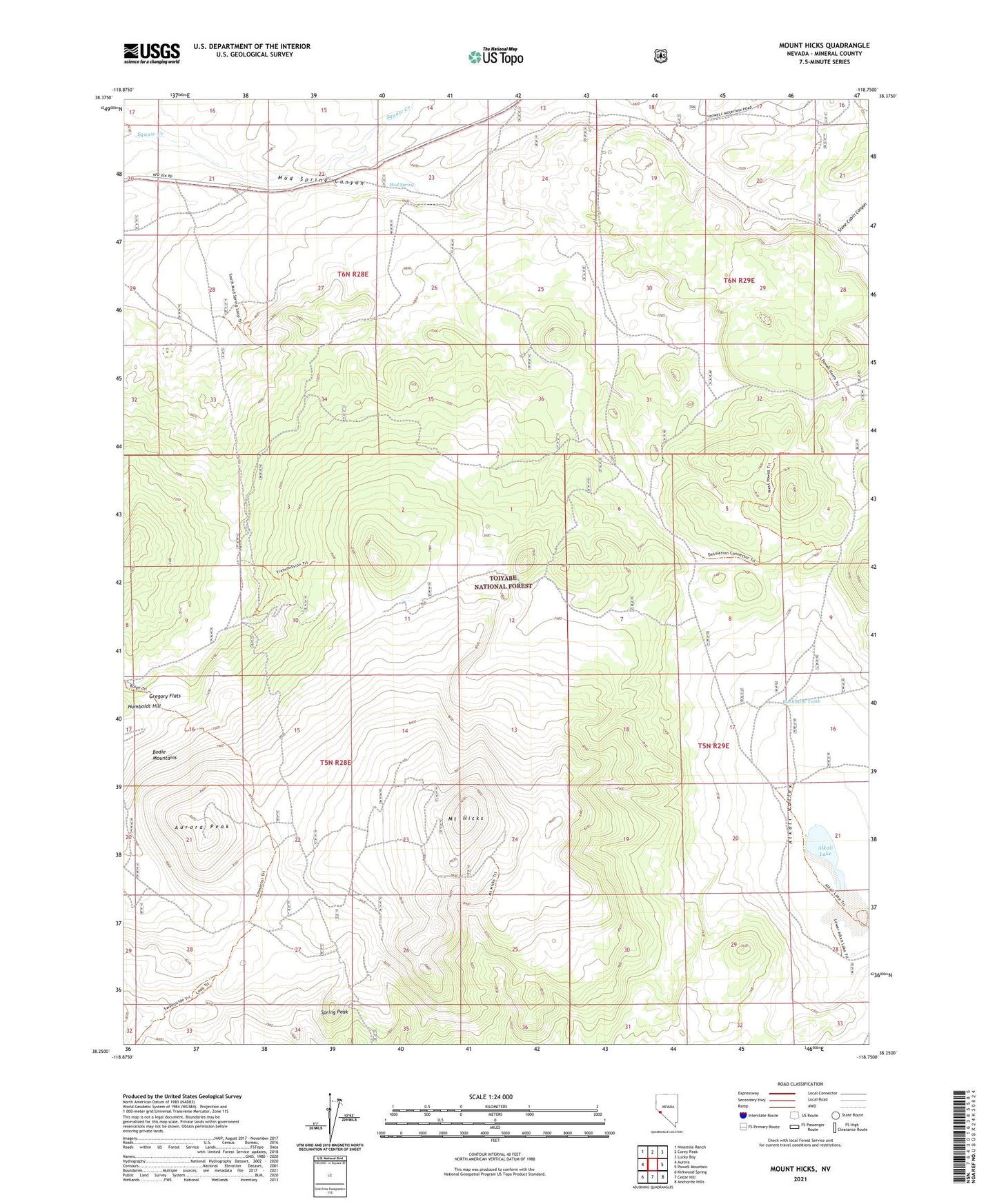
Mount Hicks Nevada US Topo Map
Couldn't load pickup availability
Also explore the Mount Hicks Forest Service Topo of this same quad for updated USFS data
2023 topographic map quadrangle Mount Hicks in the state of Nevada. Scale: 1:24000. Based on the newly updated USGS 7.5' US Topo map series, this map is in the following counties: Mineral. The map contains contour data, water features, and other items you are used to seeing on USGS maps, but also has updated roads and other features. This is the next generation of topographic maps. Printed on high-quality waterproof paper with UV fade-resistant inks.
Quads adjacent to this one:
West: Aurora
Northwest: Ninemile Ranch
North: Corey Peak
Northeast: Lucky Boy
East: Powell Mountain
Southeast: Anchorite Hills
South: Cedar Hill
Southwest: Kirkwood Spring
This map covers the same area as the classic USGS quad with code o38118c7.
Contains the following named places: Alkali Lake, Aurora Consolidated Mine, Aurora Mining District, Aurora Peak, Bodie Mountains, Burkham Tank, Claytons Ranch, Gregory Flats, Mount Hicks, Mud Spring, Mud Spring Canyon, Spring Peak, Stone Cabin Canyon