MyTopo
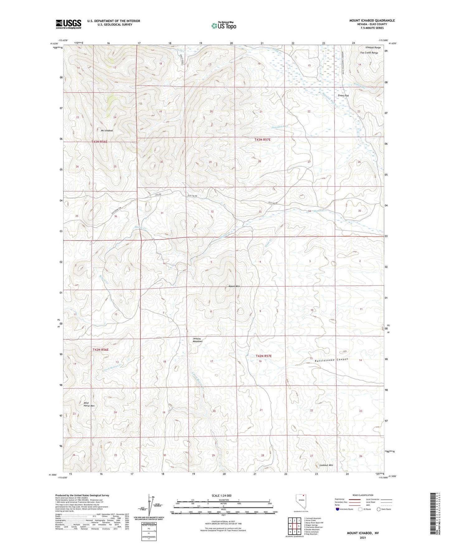
Mount Ichabod Nevada US Topo Map
Couldn't load pickup availability
2021 topographic map quadrangle Mount Ichabod in the state of Nevada. Scale: 1:24000. Based on the newly updated USGS 7.5' US Topo map series, this map is in the following counties: Elko. The map contains contour data, water features, and other items you are used to seeing on USGS maps, but also has updated roads and other features. This is the next generation of topographic maps. Printed on high-quality waterproof paper with UV fade-resistant inks.
Quads adjacent to this one:
West: Wagon Springs
Northwest: Cornwall Mountain
North: Annie Creek
Northeast: Marys River Basin NW
East: Charleston Reservoir
Southeast: Stag Mountain
South: Devils Armchair
Southwest: Double Mountain
This map covers the same area as the classic USGS quad with code o41115e5.
Contains the following named places: A Torreuil Ranch, Dam Gulch Creek, Dolly Creek, Dry Lake Reservoir, Evans Flat, F Shively Ranch, J M Prunty Ranch, Jenkins Meadows, Lookout Mountain, Mason Mountain, Mount Ichabod, P R Prunty Ranch, Stage Creek, Wild Horse Mountain, Willow Creek