MyTopo
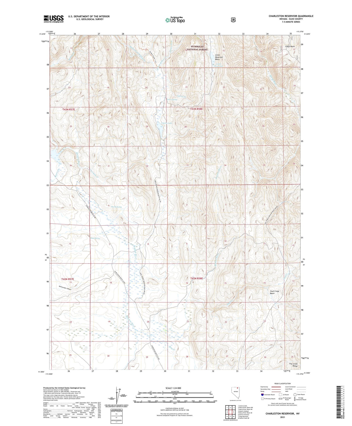
Charleston Reservoir Nevada US Topo Map
Couldn't load pickup availability
Also explore the Charleston Reservoir Forest Service Topo of this same quad for updated USFS data
2021 topographic map quadrangle Charleston Reservoir in the state of Nevada. Scale: 1:24000. Based on the newly updated USGS 7.5' US Topo map series, this map is in the following counties: Elko. The map contains contour data, water features, and other items you are used to seeing on USGS maps, but also has updated roads and other features. This is the next generation of topographic maps. Printed on high-quality waterproof paper with UV fade-resistant inks.
Quads adjacent to this one:
West: Mount Ichabod
Northwest: Annie Creek
North: Marys River Basin NW
Northeast: Marys River Basin NE
East: Marys River Basin SE
Southeast: Hanks Creek NE
South: Stag Mountain
Southwest: Devils Armchair
This map covers the same area as the classic USGS quad with code o41115e4.
Contains the following named places: Chalk Basin, Charleston Reservoir, Charleston Reservoir Dam, Chevelier Ranch, Coyote Creek, Coyote Lake, East Fork Willow Creek, Hidden Fork, Little Reservoir, Little Reservoir Basin, Lostra Ranch, Lostra Spring, Mason Creek, Prunty Spring, Rattlesnake Canyon, Seventyone Camp, Stag Creek, Stud Creek, Stud Creek Basin, Wash Spring