MyTopo
Annie Creek Nevada US Topo Map
Couldn't load pickup availability
Also explore the Annie Creek Forest Service Topo of this same quad for updated USFS data
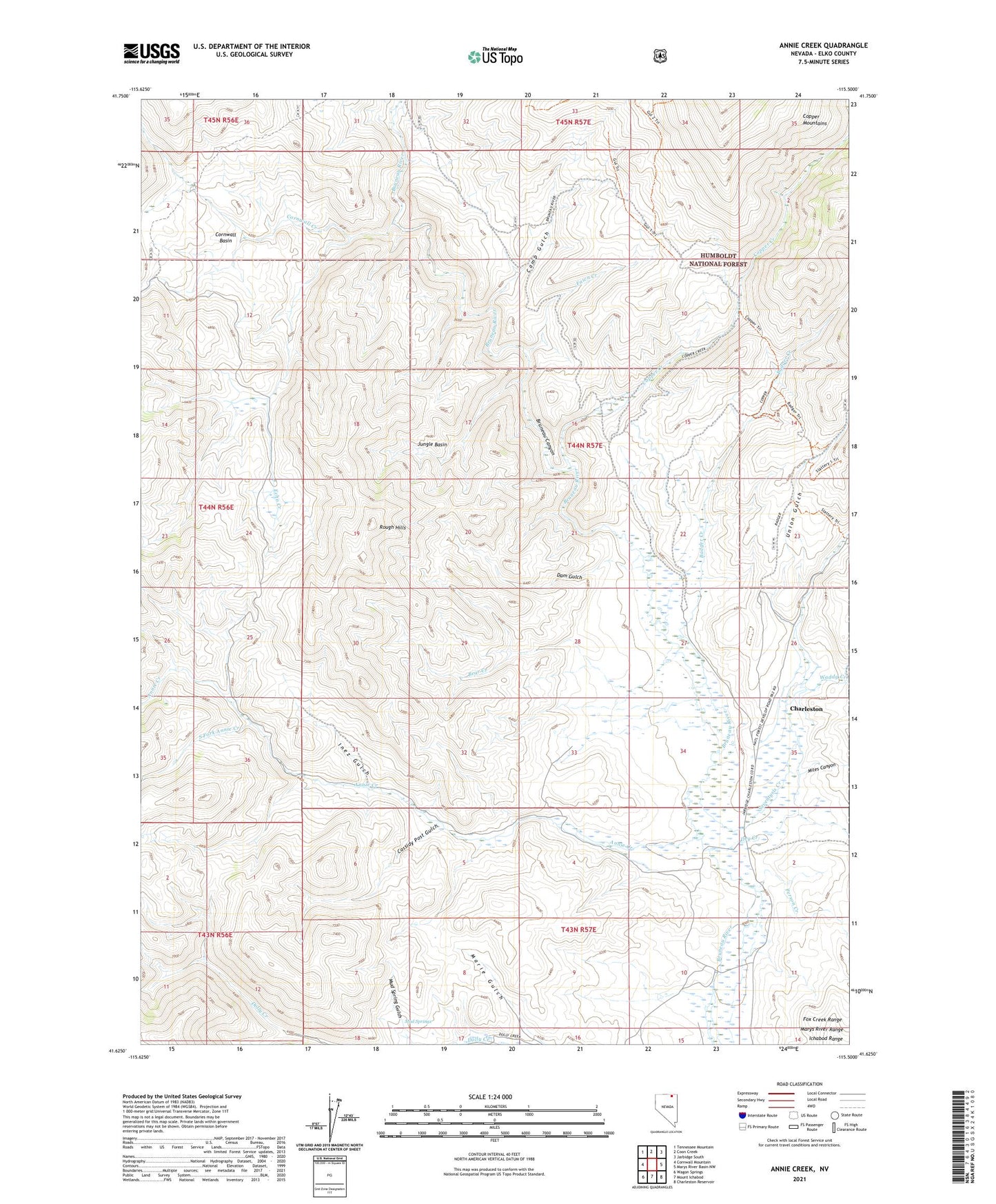
2021 topographic map quadrangle Annie Creek in the state of Nevada. Scale: 1:24000. Based on the newly updated USGS 7.5' US Topo map series, this map is in the following counties: Elko. The map contains contour data, water features, and other items you are used to seeing on USGS maps, but also has updated roads and other features. This is the next generation of topographic maps. Printed on high-quality waterproof paper with UV fade-resistant inks.
Quads adjacent to this one:
West: Cornwall Mountain
Northwest: Tennessee Mountain
North: Coon Creek
Northeast: Jarbidge South
East: Marys River Basin NW
Southeast: Charleston Reservoir
South: Mount Ichabod
Southwest: Wagon Springs
This map covers the same area as the classic USGS quad with code o41115f5.
Contains the following named places: Annie Creek, B Prunty Ranch, Badger Creek, Bayard, Bayard Post Office, Bear Creek, Browns Cabin, Bryan School, Camp Gulch, Cassidy Post Gulch, Charleston, Charleston Mining District, Charleston Post Office, Colvin Ranch, Copper Creek, Cornwall Basin, Cornwall Creek, Dam Gulch, Dry Creek, E Prunty Ranch, Echo Creek, Fawn Creek, Goodwin Ranch, Guerricabita Ranch, H Shively Ranch, Inez Gulch, Jungle Basin, Marie Gulch, McKnights Placer Mine, Miles Canyon, Mud Spring Gulch, Mud Springs, Person Creek, Rough Hills, Seventysix Creek, South Fork Annie Creek, Union Gulch, Waddy Creek, Walker Ranch