
MyTopo
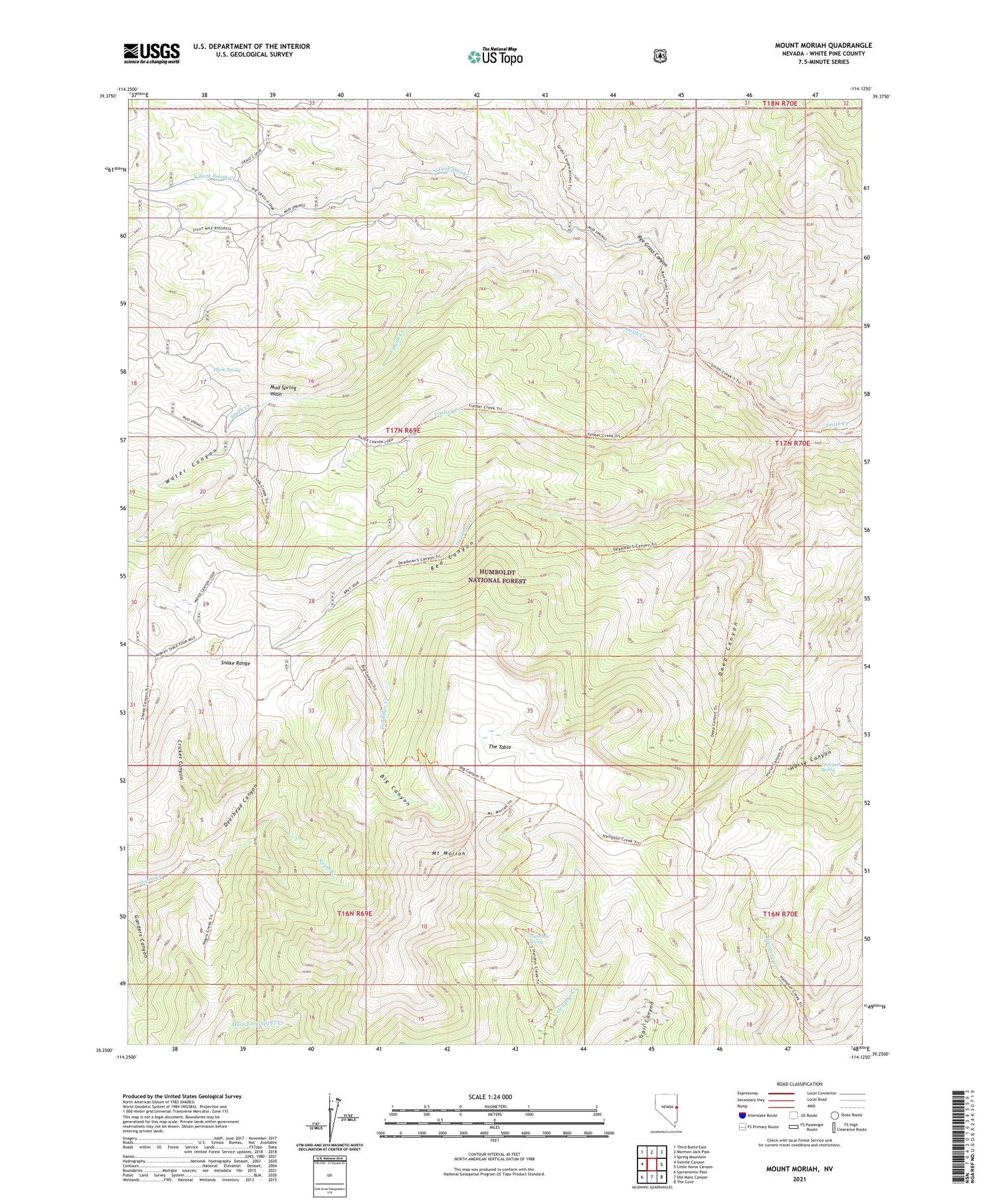
Mount Moriah Nevada US Topo Map
Couldn't load pickup availability
Also explore the Mount Moriah Forest Service Topo of this same quad for updated USFS data
2021 topographic map quadrangle Mount Moriah in the state of Nevada. Scale: 1:24000. Based on the newly updated USGS 7.5' US Topo map series, this map is in the following counties: White Pine. The map contains contour data, water features, and other items you are used to seeing on USGS maps, but also has updated roads and other features. This is the next generation of topographic maps. Printed on high-quality waterproof paper with UV fade-resistant inks.
Quads adjacent to this one:
West: Sixmile Canyon
Northwest: Third Butte East
North: Mormon Jack Pass
Northeast: Spring Mountain
East: Little Horse Canyon
Southeast: The Cove
South: Old Mans Canyon
Southwest: Sacramento Pass
This map covers the same area as the classic USGS quad with code o39114c2.
Contains the following named places: Big Canyon, Chalk Spring, Cricket Canyon, Deadman Creek, Deep Canyon, Deerhead Canyon, Hanna Mine, Moriah Cabin Administrative Site, Mount Moriah, Mount Moriah Mining Area, Mount Moriah Wilderness, Mud Spring Wash, North Fork Smith Creek, Piuma, Rye Grass Canyon, Silver Peak Mine, The Table, Tiarnleys Spring, Timber Creek, Ungopah Spring, Water Canyon


