MyTopo
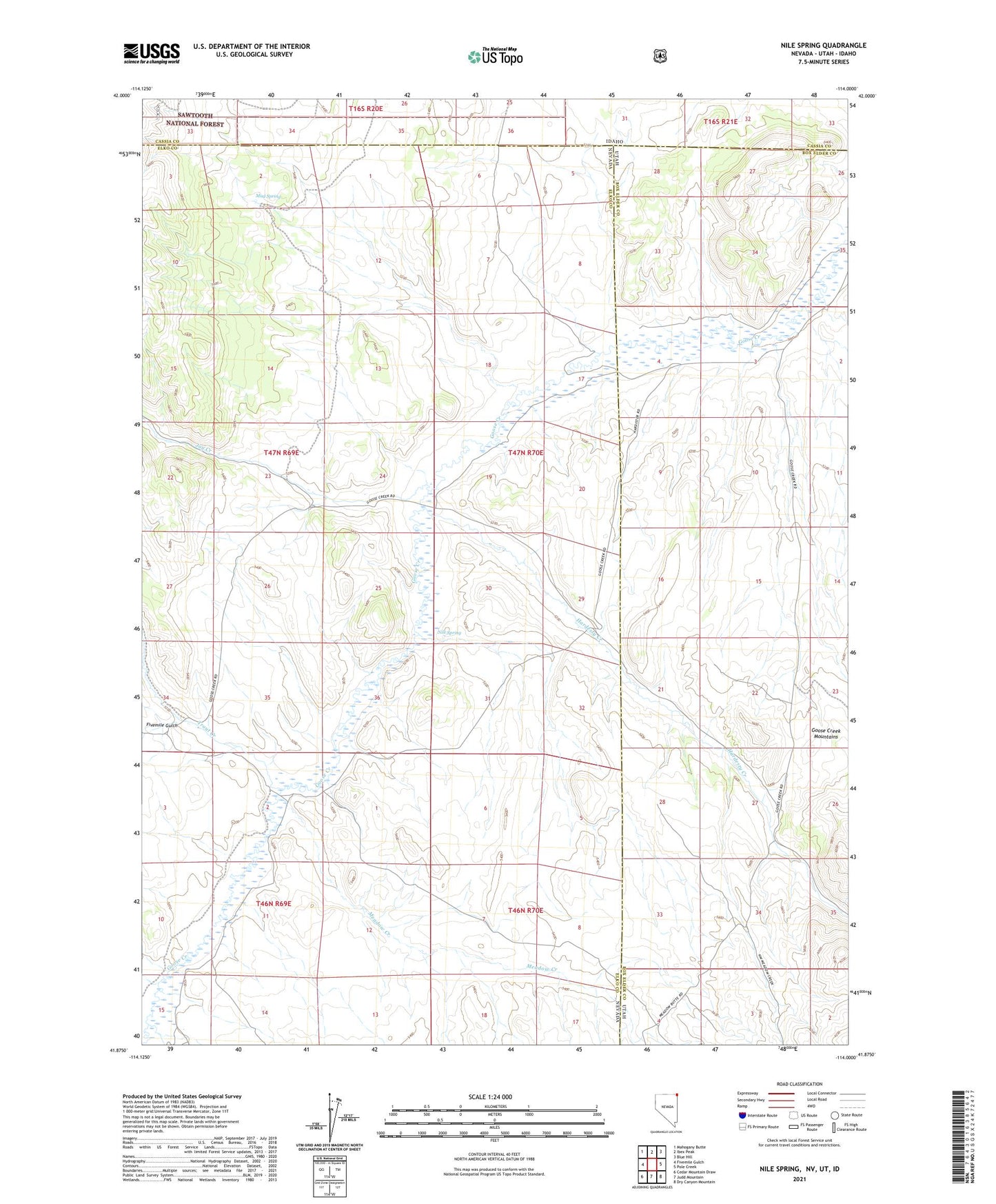
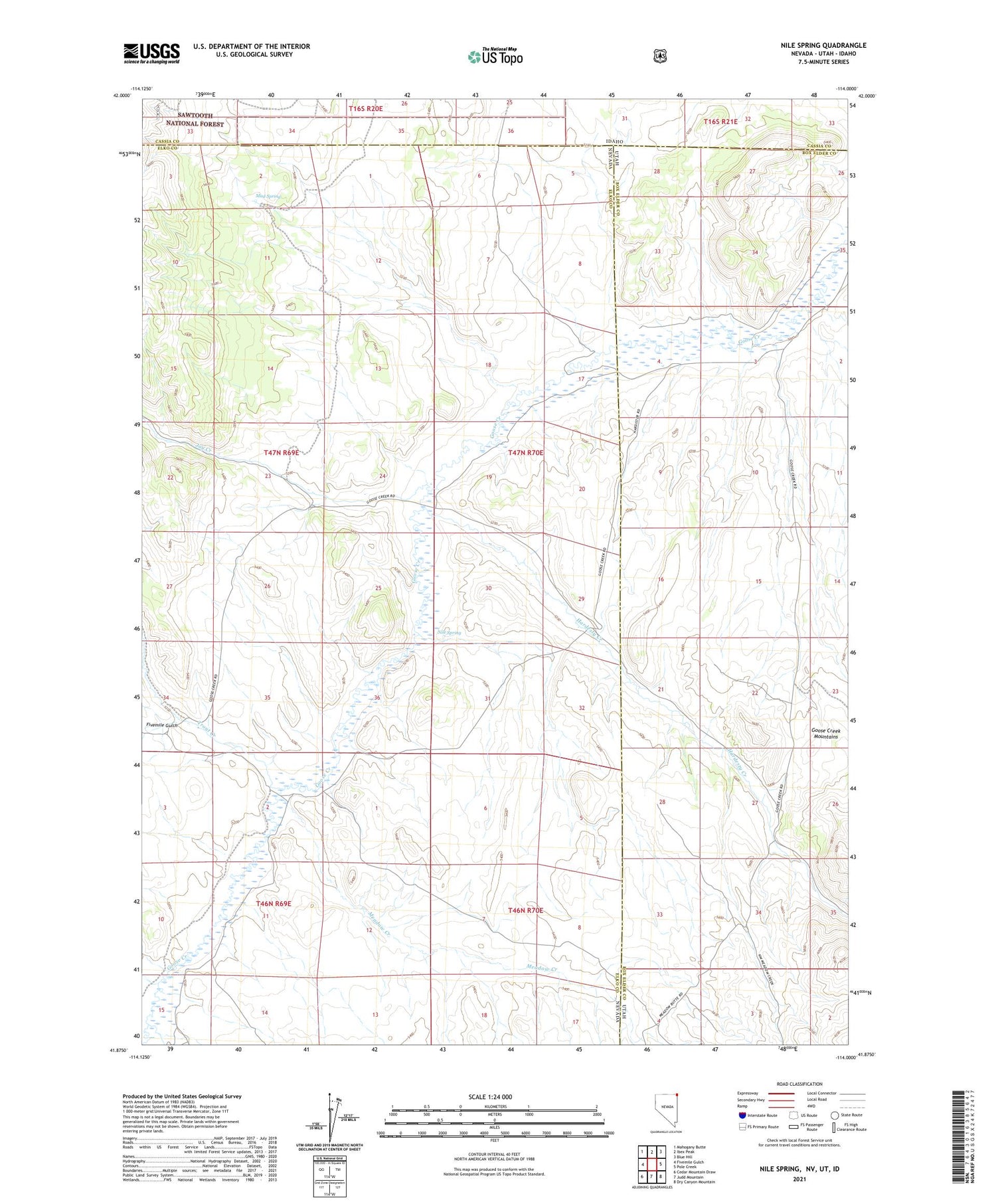
Nile Spring Nevada US Topo Map
Couldn't load pickup availability
2021 topographic map quadrangle Nile Spring in the states of Idaho, Nevada. Scale: 1:24000. Based on the newly updated USGS 7.5' US Topo map series, this map is in the following counties: Elko, Box Elder, Cassia. The map contains contour data, water features, and other items you are used to seeing on USGS maps, but also has updated roads and other features. This is the next generation of topographic maps. Printed on high-quality waterproof paper with UV fade-resistant inks.
Quads adjacent to this one:
West: Fivemile Gulch
Northwest: Mahogany Butte
North: Ibex Peak
Northeast: Blue Hill
East: Pole Creek
Southeast: Dry Canyon Mountain
South: Judd Mountain
Southwest: Cedar Mountain Draw
Contains the following named places: Bottom Creek, Fivemile Gulch, Gambles Hole, Hardesty Creek, Jay Creek, Meadow Creek, Mud Spring, Nile Spring, Spring Creek, Trout Creek, Trout Creek Ranch