MyTopo
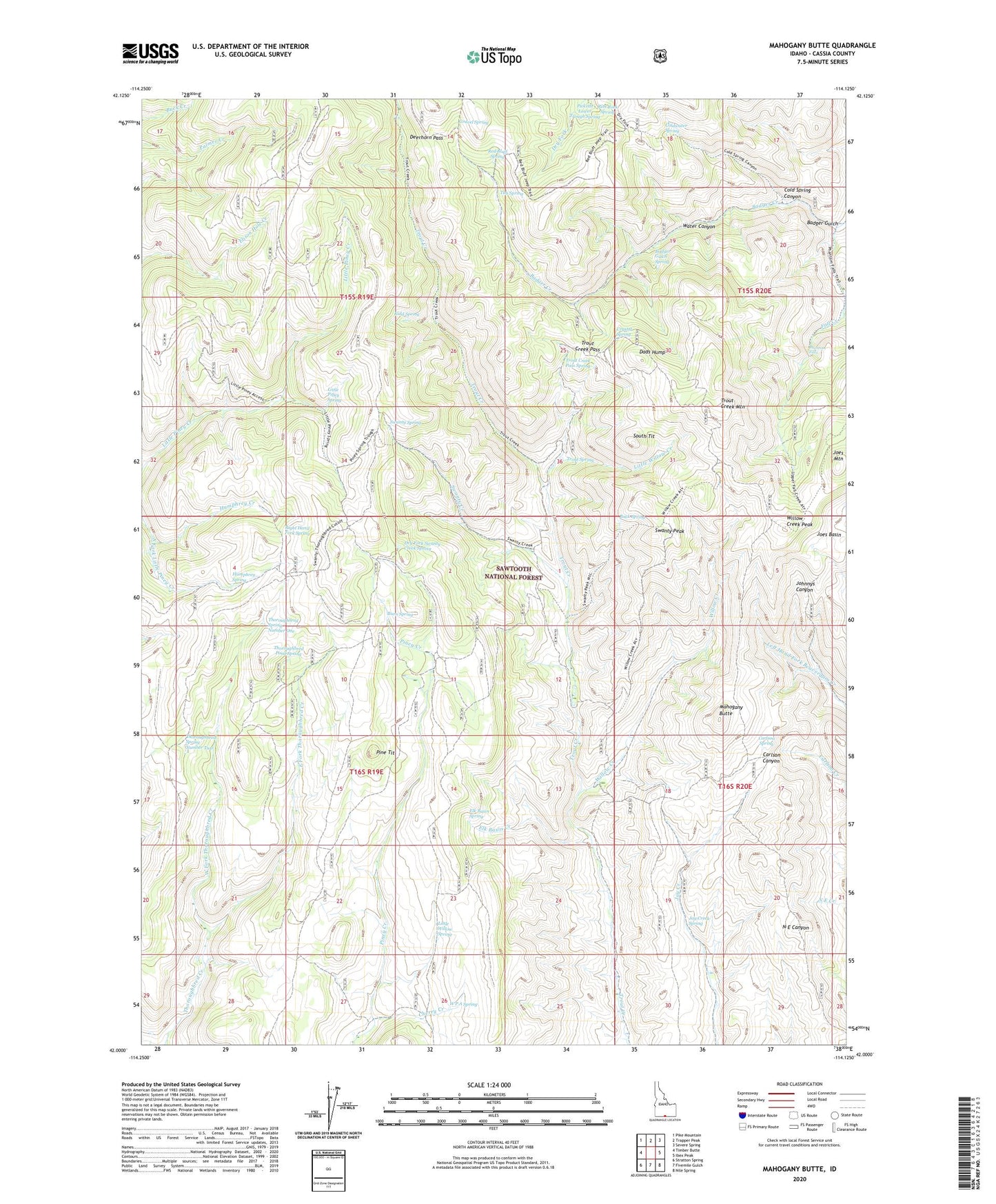
Mahogany Butte Idaho US Topo Map
Couldn't load pickup availability
Also explore the Mahogany Butte Forest Service Topo of this same quad for updated USFS data
2023 topographic map quadrangle Mahogany Butte in the state of Idaho. Scale: 1:24000. Based on the newly updated USGS 7.5' US Topo map series, this map is in the following counties: Cassia. The map contains contour data, water features, and other items you are used to seeing on USGS maps, but also has updated roads and other features. This is the next generation of topographic maps. Printed on high-quality waterproof paper with UV fade-resistant inks.
Quads adjacent to this one:
West: Timber Butte
Northwest: Pike Mountain
North: Trapper Peak
Northeast: Severe Spring
East: Ibex Peak
Southeast: Nile Spring
South: Fivemile Gulch
Southwest: Stratton Spring
This map covers the same area as the classic USGS quad with code o42114a2.
Contains the following named places: Badger Creek, Badger Gulch, Badger Gulch Spring, Buck Spring, Burn Spring, Carlson Spring, Cherry Creek, Cold Spring Canyon, Coldwater Spring, Crystal Spring, Dads Hump, Deerhorn Pass, Dry Fork Swanty Creek Spring, East Fork Thoroughbred Creek, Elk Basin Creek, Elk Basin Spring, Gravel Spring, Humphrey Creek, Humphrey Spring, Jay Creek Corral, Jay Creek Spring, Joes Basin, Joes Mountain, Kidd Spring, Little Piney Spring, Little Willow Creek, Little Willow Spring, Mahogany Butte, Phantom Falls, Pine Tit, Red Bluff Spring, Right Hand Fork Spring, Rim Rock Spring, South Tit, Swanty Creek, Swanty Peak, Swanty Spring, Thoroughbred Pond Spring, Thoroughbred Spring Number One, Thoroughbred Spring Number Two, Trout Creek Mountain, Trout Creek Pass, Trout Creek Pass Spring, Trout Spring, Tub Spring, W P A Spring, Water Canyon, West Fork Thoroughbred Creek, Willow Creek, Willow Creek Peak