MyTopo
North of Silver Peak Nevada US Topo Map
Couldn't load pickup availability
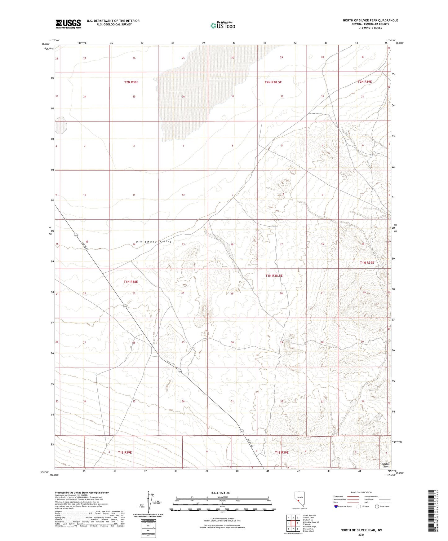
2021 topographic map quadrangle North of Silver Peak in the state of Nevada. Scale: 1:24000. Based on the newly updated USGS 7.5' US Topo map series, this map is in the following counties: Esmeralda. The map contains contour data, water features, and other items you are used to seeing on USGS maps, but also has updated roads and other features. This is the next generation of topographic maps. Printed on high-quality waterproof paper with UV fade-resistant inks.
Quads adjacent to this one:
West: Rhyolite Ridge NE
Northwest: Blair Junction
North: Devils Gate
Northeast: Gilbert SE
East: Weepah
Southeast: Goat Island
South: Silver Peak
Southwest: Rhyolite Ridge
This map covers the same area as the classic USGS quad with code o37117h6.
Contains the following named places: Alum, Alum Mine, Alum Mining District, Alum Well, Griffing and Wynants Borax Works, Minnesota Well, Wood Yard