MyTopo
Devils Gate Nevada US Topo Map
Couldn't load pickup availability
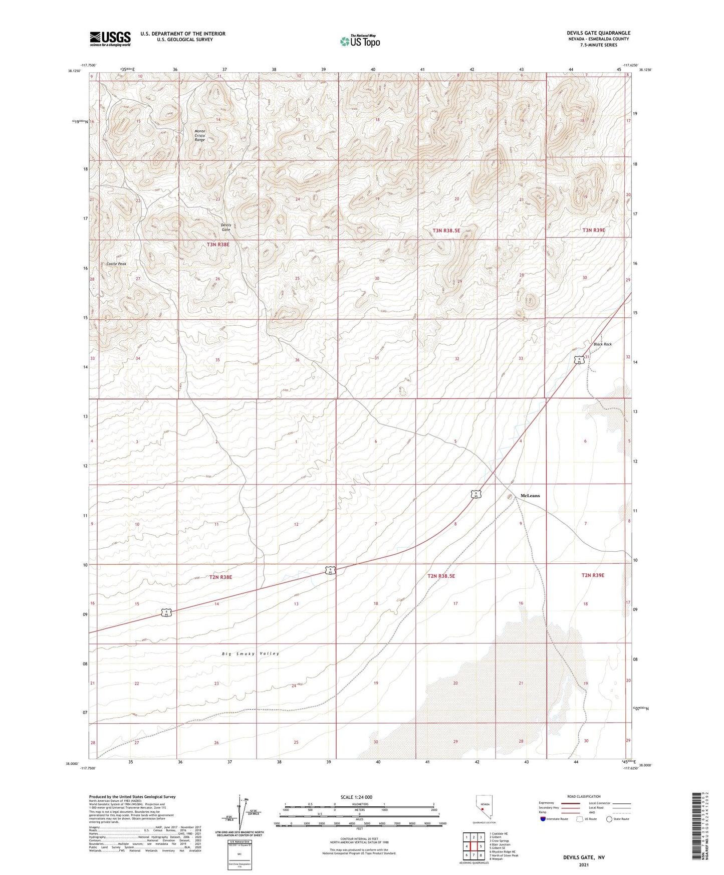
2021 topographic map quadrangle Devils Gate in the state of Nevada. Scale: 1:24000. Based on the newly updated USGS 7.5' US Topo map series, this map is in the following counties: Esmeralda. The map contains contour data, water features, and other items you are used to seeing on USGS maps, but also has updated roads and other features. This is the next generation of topographic maps. Printed on high-quality waterproof paper with UV fade-resistant inks.
Quads adjacent to this one:
West: Blair Junction
Northwest: Coaldale NE
North: Gilbert
Northeast: Crow Springs
East: Gilbert SE
Southeast: Weepah
South: North of Silver Peak
Southwest: Rhyolite Ridge NE
This map covers the same area as the classic USGS quad with code o38117a6.
Contains the following named places: Alto Divide Mine, Black Rock, Castle Peak, Castle Peak Mine, Castle Rock Mine, Deep Wells, Desert Well, Devils Gate, Gilbert Junction, McLeans, Original Gilbert Mine