MyTopo
Weepah Nevada US Topo Map
Couldn't load pickup availability
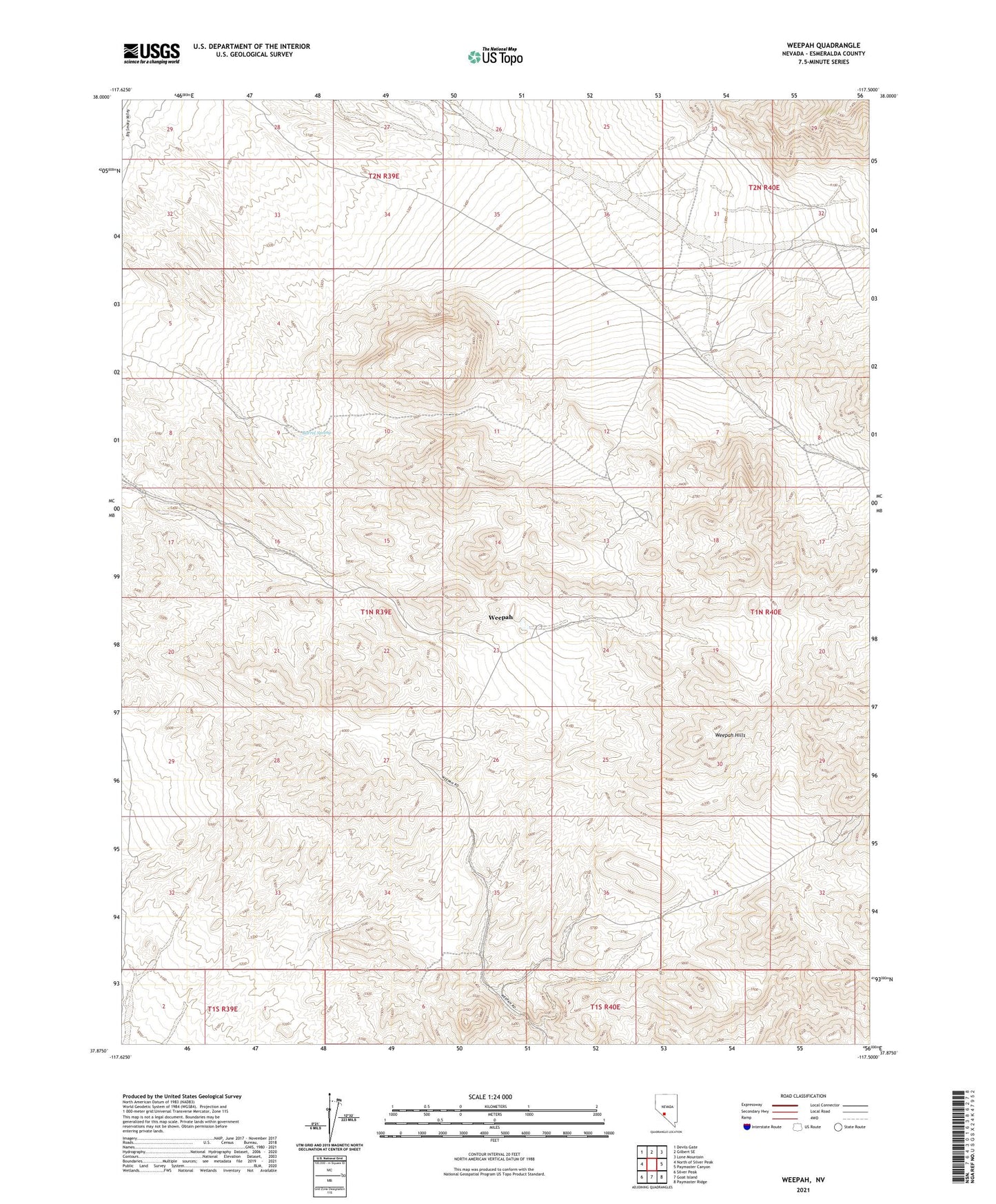
2021 topographic map quadrangle Weepah in the state of Nevada. Scale: 1:24000. Based on the newly updated USGS 7.5' US Topo map series, this map is in the following counties: Esmeralda. The map contains contour data, water features, and other items you are used to seeing on USGS maps, but also has updated roads and other features. This is the next generation of topographic maps. Printed on high-quality waterproof paper with UV fade-resistant inks.
Quads adjacent to this one:
West: North of Silver Peak
Northwest: Devils Gate
North: Gilbert SE
Northeast: Lone Mountain
East: Paymaster Canyon
Southeast: Paymaster Ridge
South: Goat Island
Southwest: Silver Peak
This map covers the same area as the classic USGS quad with code o37117h5.
Contains the following named places: American Mine, Barrel Spring, Electric Gold Mines, Jet Mine, The Wee Pah Lookout Mines, United Weepah and Western Mines Corporation Mines, Weepah, Weepah Combination Mines, Weepah Development and Mines Company Mines, Weepah Diamond Gold Mining Company Mines, Weepah Discovery Gold Mines Company Mines, Weepah Electric Extension Gold Mining Company Mines, Weepah Gold Mines Company Mines, Weepah Hills, Weepah Horton Company Mill, Weepah Horton Junior Gold Mines Company Mines, Weepah Metals Corporation Mines, Weepah Mine, Weepah Mining District, Weepah Nevada Mining Company Mill, Weepah Nevada Mining Company Mines, Weepah Post Office, Weepah United Mines