MyTopo
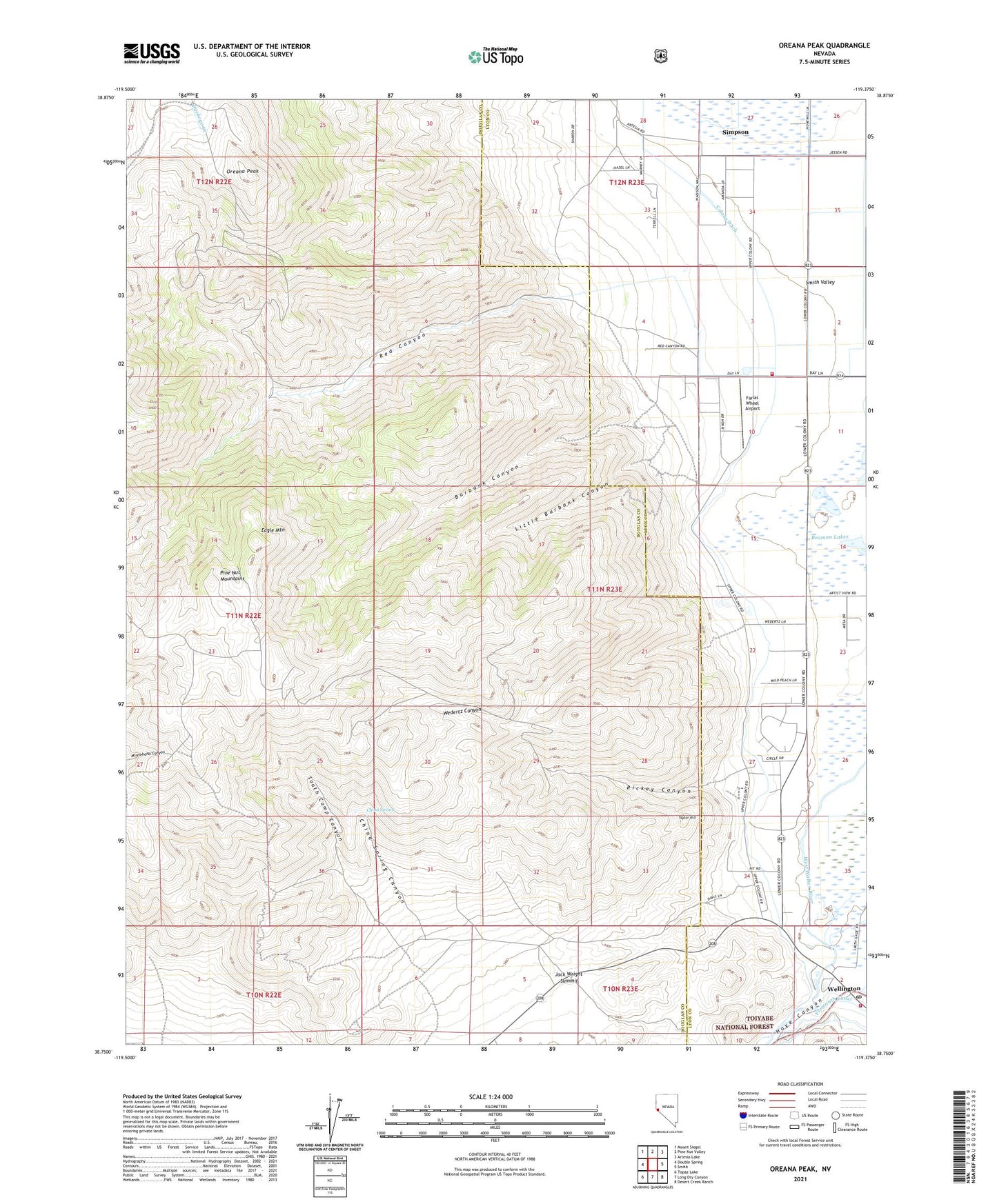
Oreana Peak Nevada US Topo Map
Couldn't load pickup availability
2021 topographic map quadrangle Oreana Peak in the state of Nevada. Scale: 1:24000. Based on the newly updated USGS 7.5' US Topo map series, this map is in the following counties: Douglas, Lyon. The map contains contour data, water features, and other items you are used to seeing on USGS maps, but also has updated roads and other features. This is the next generation of topographic maps. Printed on high-quality waterproof paper with UV fade-resistant inks.
Quads adjacent to this one:
West: Double Spring
Northwest: Mount Siegel
North: Pine Nut Valley
Northeast: Artesia Lake
East: Smith
Southeast: Desert Creek Ranch
South: Long Dry Canyon
Southwest: Topaz Lake
Contains the following named places: Acciari Ranch, Burbank Canyon, China Spring, China Spring Canyon, Colony Ditch, Eagle Mountain, Farias Wheel Airport, Granton Ranch, Hoye, Hoye Canyon, Jack Wright Summit, Little Burbank Canyon, Lucky Bill Mine, Oreana Peak, Red Canyon, Red Canyon Mine, Rickey Canyon, Silver Glance Mining District, Simpson, Simpson Post Office, Simpson Ranch, Smith Valley Fire Protection District Station 41, Smith Valley Fire Protection District Station 42, South Camp Canyon, South Camp Mine, Taylor Hill, Taylor Hill Mine, Valley View Landing Strip, Wedertz Canyon, Wellington, Wellington Post Office, Winters Mine, Wrights Bridge, Wyandotte Mine, Yankee Girl Mine