MyTopo
Pine Nut Valley Nevada US Topo Map
Couldn't load pickup availability
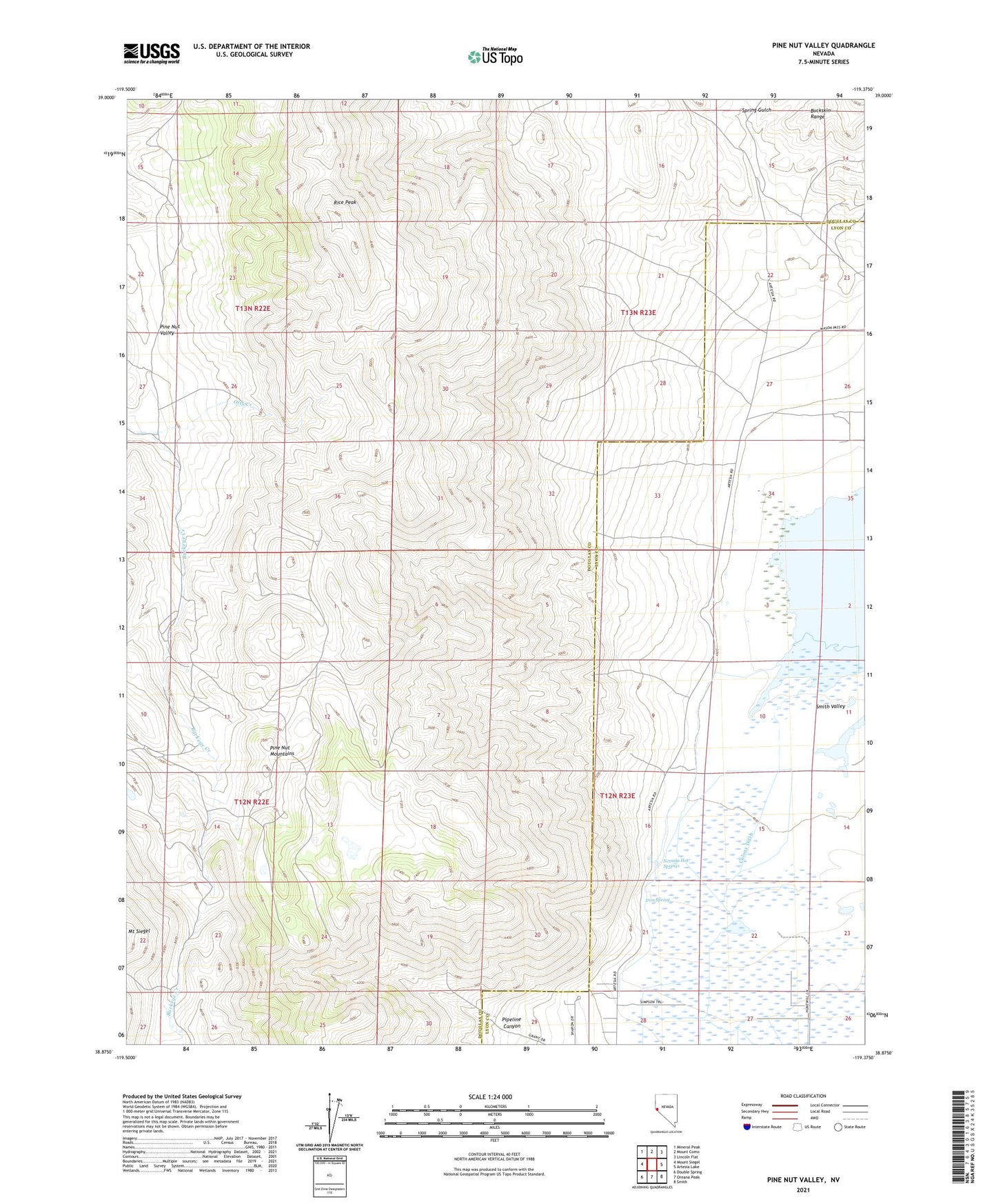
2021 topographic map quadrangle Pine Nut Valley in the state of Nevada. Scale: 1:24000. Based on the newly updated USGS 7.5' US Topo map series, this map is in the following counties: Douglas, Lyon. The map contains contour data, water features, and other items you are used to seeing on USGS maps, but also has updated roads and other features. This is the next generation of topographic maps. Printed on high-quality waterproof paper with UV fade-resistant inks.
Quads adjacent to this one:
West: Mount Siegel
Northwest: Mineral Peak
North: Mount Como
Northeast: Lincoln Flat
East: Artesia Lake
Southeast: Smith
South: Oreana Peak
Southwest: Double Spring
This map covers the same area as the classic USGS quad with code o38119h4.
Contains the following named places: Artesia, Artesia Post Office, Blue Metal Mine, Iron Spring, Mount Siegel Mining District, Nevada Hot Springs, Otts Creek, Pine Nut Division, Pine Nut Valley, Pipeline Canyon, Rice Peak, Slaters Mine, Spring Gulch