MyTopo
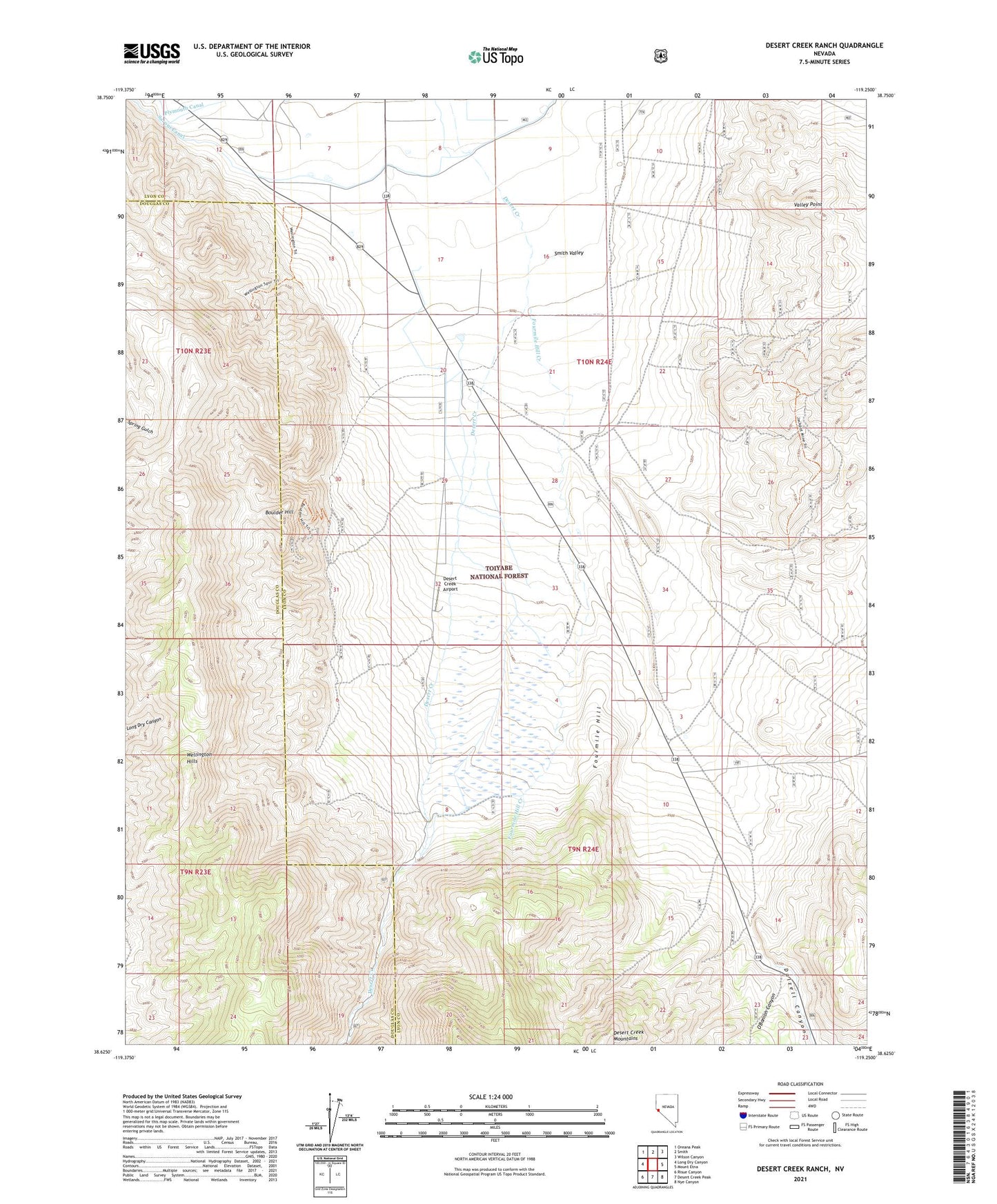
Desert Creek Ranch Nevada US Topo Map
Couldn't load pickup availability
Also explore the Desert Creek Ranch Forest Service Topo of this same quad for updated USFS data
2021 topographic map quadrangle Desert Creek Ranch in the state of Nevada. Scale: 1:24000. Based on the newly updated USGS 7.5' US Topo map series, this map is in the following counties: Lyon, Douglas. The map contains contour data, water features, and other items you are used to seeing on USGS maps, but also has updated roads and other features. This is the next generation of topographic maps. Printed on high-quality waterproof paper with UV fade-resistant inks.
Quads adjacent to this one:
West: Long Dry Canyon
Northwest: Oreana Peak
North: Smith
Northeast: Wilson Canyon
East: Mount Etna
Southeast: Nye Canyon
South: Desert Creek Peak
Southwest: Risue Canyon
This map covers the same area as the classic USGS quad with code o38119f3.
Contains the following named places: Boulder Hill, Boulder Hill Mine, Dalzell Canyon, Desert Creek Airport, Desert Creek Ranch, Fourmile Hill, Fourmile Hill Creek, Jackpot Mine, Jackrabbit Mine, Johnsons, Lobdells, Mather, Millers, O'Banion Canyon, Rodson Ranch, Rosaschi Ranch, Saroni Canal, Smith Valley Mine, Valley Point