MyTopo
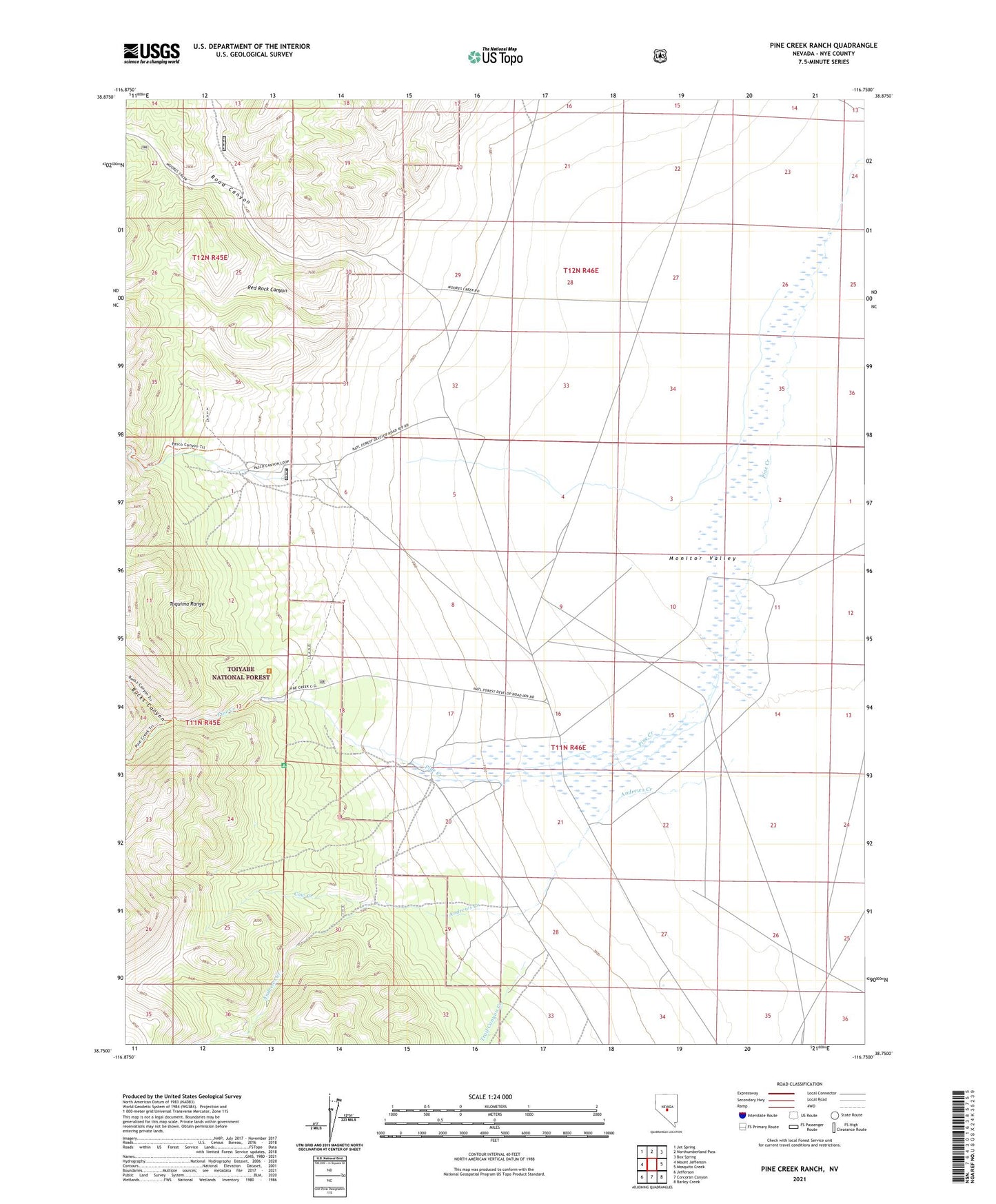
Pine Creek Ranch Nevada US Topo Map
Couldn't load pickup availability
Also explore the Pine Creek Ranch Forest Service Topo of this same quad for updated USFS data
2021 topographic map quadrangle Pine Creek Ranch in the state of Nevada. Scale: 1:24000. Based on the newly updated USGS 7.5' US Topo map series, this map is in the following counties: Nye. The map contains contour data, water features, and other items you are used to seeing on USGS maps, but also has updated roads and other features. This is the next generation of topographic maps. Printed on high-quality waterproof paper with UV fade-resistant inks.
Quads adjacent to this one:
West: Mount Jefferson
Northwest: Jet Spring
North: Northumberland Pass
Northeast: Box Spring
East: Mosquito Creek
Southeast: Barley Creek
South: Corcoran Canyon
Southwest: Jefferson
This map covers the same area as the classic USGS quad with code o38116g7.
Contains the following named places: Andrews Creek, Bucks Canyon, Cow Creek, Pasco Canyon, Pine Creek, Pine Creek Forest Service Recreation Site, Pine Creek Post Office, Pine Creek Ranch, Pioneer, Pioneer Post Office, Red Rock Canyon, Road Canyon, Round Mountain Division, Trail Canyon Creek