MyTopo
Pine Grove Spring Nevada US Topo Map
Couldn't load pickup availability
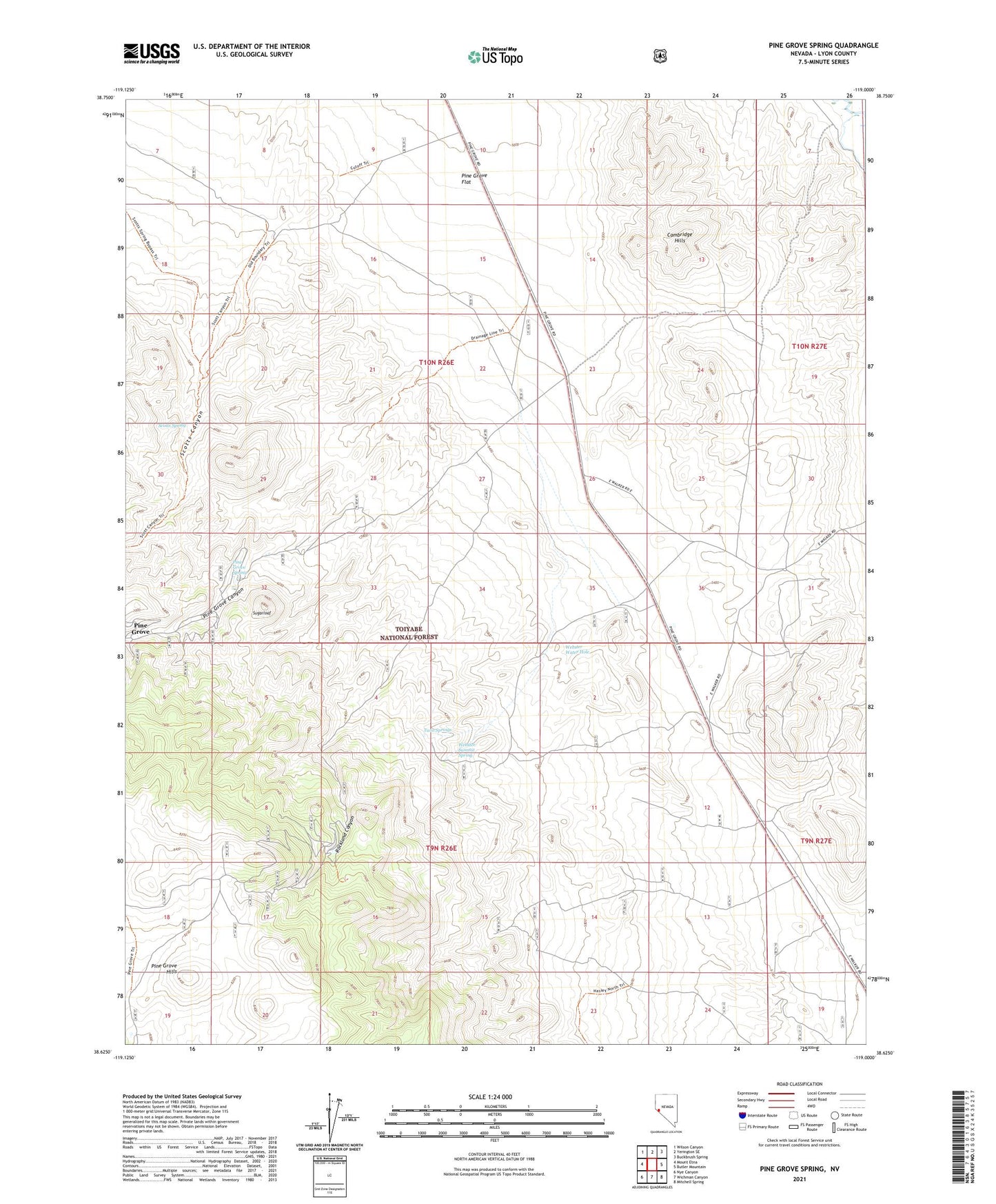
2021 topographic map quadrangle Pine Grove Spring in the state of Nevada. Scale: 1:24000. Based on the newly updated USGS 7.5' US Topo map series, this map is in the following counties: Lyon. The map contains contour data, water features, and other items you are used to seeing on USGS maps, but also has updated roads and other features. This is the next generation of topographic maps. Printed on high-quality waterproof paper with UV fade-resistant inks.
Quads adjacent to this one:
West: Mount Etna
Northwest: Wilson Canyon
North: Yerington SE
Northeast: Buckbrush Spring
East: Butler Mountain
Southeast: Mitchell Spring
South: Wichman Canyon
Southwest: Nye Canyon
Contains the following named places: Cambridge, Cambridge Mine, Cambridge Post Office, Pine Grove, Pine Grove Canyon, Pine Grove Drift Fence and Cattle Guard, Pine Grove Flat, Pine Grove Post Office, Pine Grove Spring, Rockland, Rockland Canyon, Rockland Mine Post Office, Rockland Mines, Rockland Post Office, Scotts Canyon, Scotts Spring, Sugarloaf, Twin Springs, Webster Summit Drift Fence, Webster Summit Spring, Webster Water Hole, Wheeler Flat Dam, Wheeler Mine, Wilson Mines