MyTopo
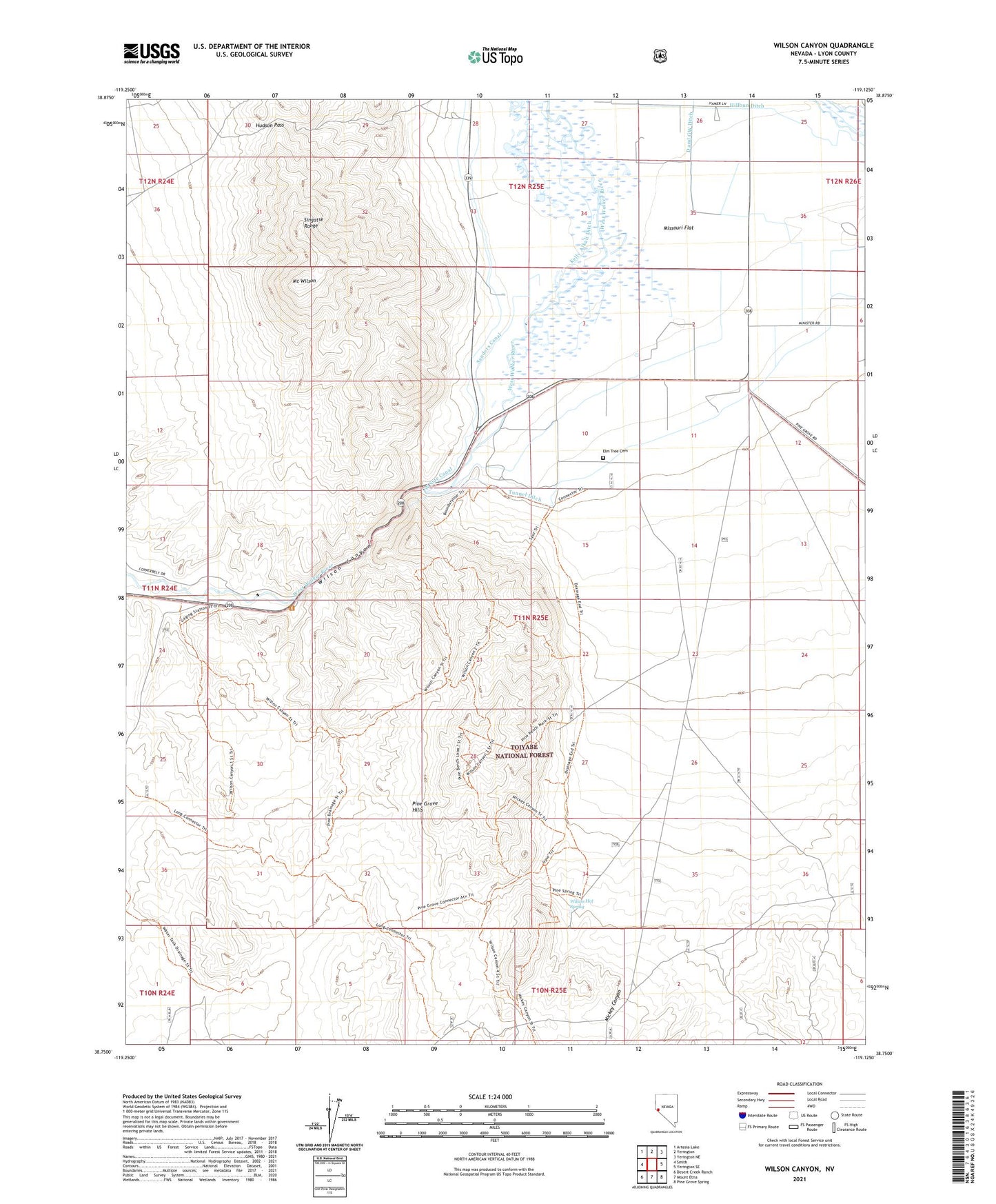
Wilson Canyon Nevada US Topo Map
Couldn't load pickup availability
Also explore the Wilson Canyon Forest Service Topo of this same quad for updated USFS data
2021 topographic map quadrangle Wilson Canyon in the state of Nevada. Scale: 1:24000. Based on the newly updated USGS 7.5' US Topo map series, this map is in the following counties: Lyon. The map contains contour data, water features, and other items you are used to seeing on USGS maps, but also has updated roads and other features. This is the next generation of topographic maps. Printed on high-quality waterproof paper with UV fade-resistant inks.
Quads adjacent to this one:
West: Smith
Northwest: Artesia Lake
North: Yerington
Northeast: Yerington NE
East: Yerington SE
Southeast: Pine Grove Spring
South: Mount Etna
Southwest: Desert Creek Ranch
This map covers the same area as the classic USGS quad with code o38119g2.
Contains the following named places: D and GW Ditch, Elm Tree Cemetery, Hillbun Ditch, Hudson Pass, Kelly Alkali Ditch, Lee and Sanders Grist Mill, Lee Sanders Ditch, Mickey Canyon, Missouri Flat, Missouri Flat Drift Fence, Missouri Flat Well, Mount Wilson, Sanders Canal, Tippecanoe, Tippecanoe Post Office, Tunnel Ditch, Wellington Springs, West Side Canal, Wilson, Wilson Canyon, Wilson Canyon Picnic Area, Wilson Hot Spring, ZIP Code: 89447