MyTopo
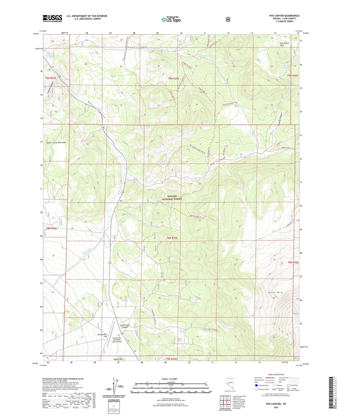
Nye Canyon Nevada US Topo Map
Couldn't load pickup availability
Also explore the Nye Canyon Forest Service Topo of this same quad for updated USFS data
2021 topographic map quadrangle Nye Canyon in the state of Nevada. Scale: 1:24000. Based on the newly updated USGS 7.5' US Topo map series, this map is in the following counties: Lyon. The map contains contour data, water features, and other items you are used to seeing on USGS maps, but also has updated roads and other features. This is the next generation of topographic maps. Printed on high-quality waterproof paper with UV fade-resistant inks.
Quads adjacent to this one:
West: Desert Creek Peak
Northwest: Desert Creek Ranch
North: Mount Etna
Northeast: Pine Grove Spring
East: Wichman Canyon
Southeast: The Elbow
South: Sweetwater Creek
Southwest: Mount Patterson
This map covers the same area as the classic USGS quad with code o38119e2.
Contains the following named places: Big Crystal Mine, Dead Ox Canyon, Dead Ox Spring, Garden Canyon, Garden Canyon Spring, Gulch Spring, Nye Canyon, Nyes, Rye Grass Spring, Sand Canyon, Sand Canyon Spring, Sheep Creek, Sweetwater (US Marine Corps) Airport, Sweetwater Summit, Wiley Ditch, Wiley Ranch, Wileys Station