MyTopo
Pinto Springs Nevada US Topo Map
Couldn't load pickup availability
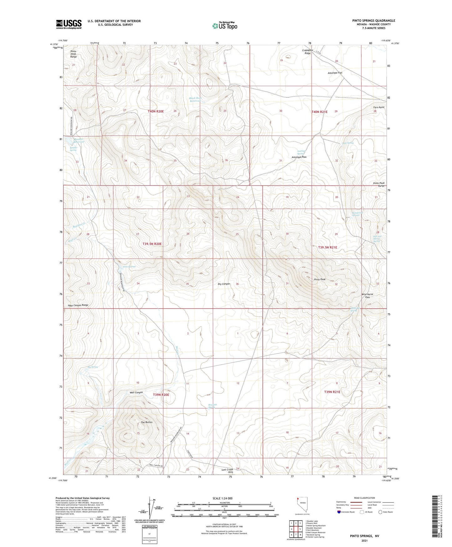
2021 topographic map quadrangle Pinto Springs in the state of Nevada. Scale: 1:24000. Based on the newly updated USGS 7.5' US Topo map series, this map is in the following counties: Washoe. The map contains contour data, water features, and other items you are used to seeing on USGS maps, but also has updated roads and other features. This is the next generation of topographic maps. Printed on high-quality waterproof paper with UV fade-resistant inks.
Quads adjacent to this one:
West: Boulder Mountain
Northwest: Boulder Lake
North: Powers Well
Northeast: Nellie Spring Mountain
East: Hart Mountain
Southeast: Chester Lyons Spring
South: Bordwell Spring
Southwest: Wall Canyon Reservoir
This map covers the same area as the classic USGS quad with code o41119c6.
Contains the following named places: Antelope Pass, Antelope Spring, Big Spring, Black Rock Reservoir, Boulder Reservoir, Boulder Spring, Brackish Spring, Dry Canyon, Fern Point, Horehound Springs, Lope Spring, Nolan Ranch, Pick and Shovel Spring, Pinto Peak, Pinto Springs, The Buttes, Wall Canyon Windmill, Wild Horse Pass, Wildhorse Spring