MyTopo
Boulder Mountain Nevada US Topo Map
Couldn't load pickup availability
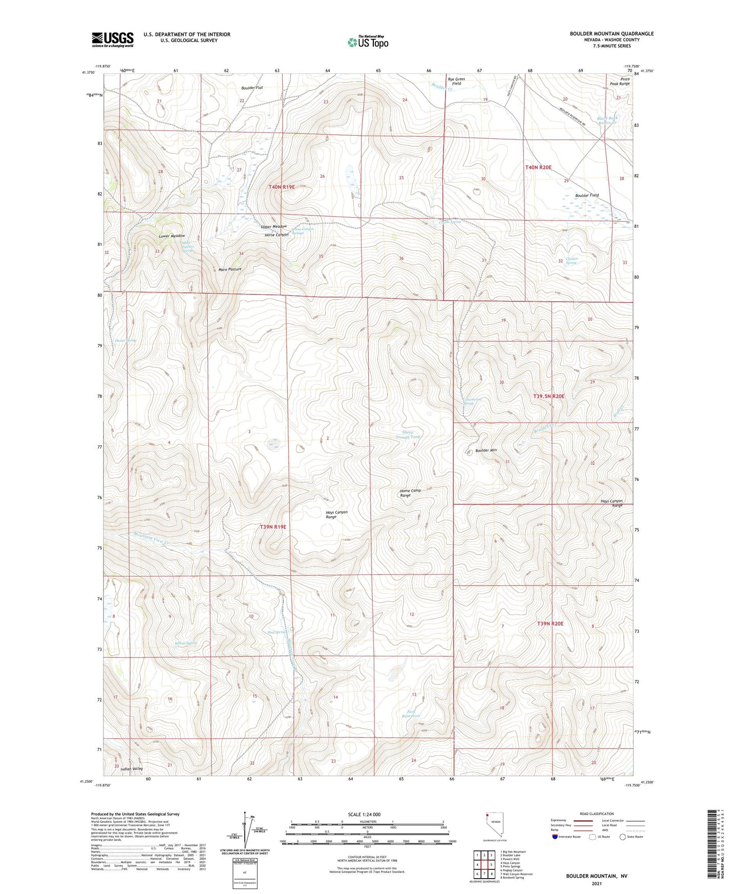
2021 topographic map quadrangle Boulder Mountain in the state of Nevada. Scale: 1:24000. Based on the newly updated USGS 7.5' US Topo map series, this map is in the following counties: Washoe. The map contains contour data, water features, and other items you are used to seeing on USGS maps, but also has updated roads and other features. This is the next generation of topographic maps. Printed on high-quality waterproof paper with UV fade-resistant inks.
Quads adjacent to this one:
West: Hays Canyon
Northwest: Big Hat Mountain
North: Boulder Lake
Northeast: Powers Well
East: Pinto Springs
Southeast: Bordwell Spring
South: Wall Canyon Reservoir
Southwest: Pegleg Canyon
This map covers the same area as the classic USGS quad with code o41119c7.
Contains the following named places: Black Rock Reservoir, Boulder Field, Boulder Mountain, Chicken Spring, Cottonwood Spring, Coyote Spring, Divine Spring, Home Camp, Home Camp Range, Horse Canyon, Horse Canyon Springs, Jack Reservoir, Lower Meadow, Mahogany Lake, Mare Pasture, Mare Pasture Spring, Mountain View Corral, Mud Spring, Sheep Trough Tank, Upper Meadow, Willow Spring