
MyTopo
Reese River Butte Nevada US Topo Map
Couldn't load pickup availability
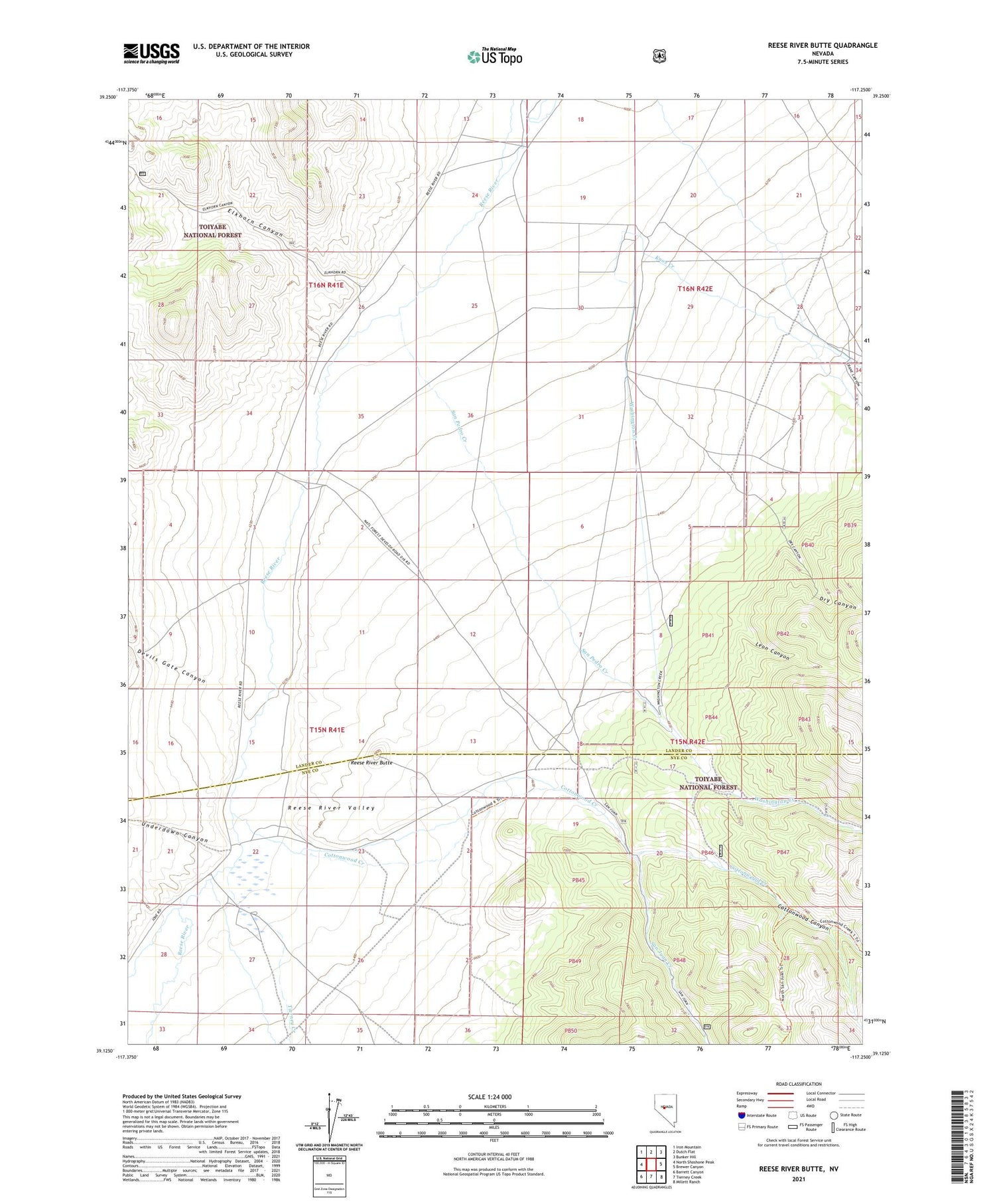
2021 topographic map quadrangle Reese River Butte in the state of Nevada. Scale: 1:24000. Based on the newly updated USGS 7.5' US Topo map series, this map is in the following counties: Lander, Nye. The map contains contour data, water features, and other items you are used to seeing on USGS maps, but also has updated roads and other features. This is the next generation of topographic maps. Printed on high-quality waterproof paper with UV fade-resistant inks.
Quads adjacent to this one:
West: North Shoshone Peak
Northwest: Iron Mountain
North: Dutch Flat
Northeast: Bunker Hill
East: Brewer Canyon
Southeast: Millett Ranch
South: Tierney Creek
Southwest: Barrett Canyon
Contains the following named places: Austin to Grantsville Stage Route, Cottonwood Canyon, Cottonwood Creek, Devils Gate Canyon, Dry Canyon, Dyer Ranch, East Ditch, Elkhorn Canyon, Heath Ranch, Knox Creek, Leon Canyon, O'Toole Ranch, Pedro, Pedro Post Office, Reese River Butte, Ryan Ditch, San Juan Creek, San Pedro Creek, Spanish Ranch, Tierney Creek, Underdown Canyon, Washington Creek


