MyTopo
Rye Patch Dam Nevada US Topo Map
Couldn't load pickup availability
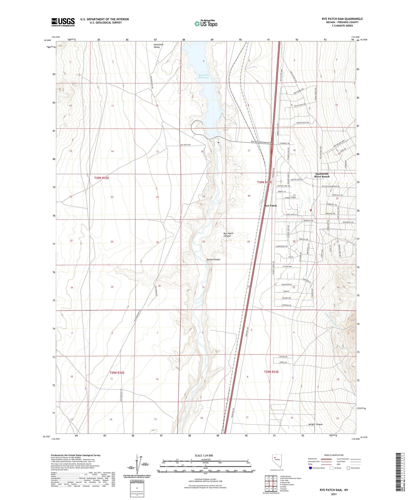
2021 topographic map quadrangle Rye Patch Dam in the state of Nevada. Scale: 1:24000. Based on the newly updated USGS 7.5' US Topo map series, this map is in the following counties: Pershing. The map contains contour data, water features, and other items you are used to seeing on USGS maps, but also has updated roads and other features. This is the next generation of topographic maps. Printed on high-quality waterproof paper with UV fade-resistant inks.
Quads adjacent to this one:
West: Oreana NW
Northwest: Poker Brown
North: Rye Patch Reservoir South
Northeast: Star Peak
East: Congress Canyon
Southeast: Rochester
South: Oreana
Southwest: Arabia
Contains the following named places: Eastside Picnic Area, Humboldt River Ranch Census Designated Place, Little Tungsten Mine, Mineral Point, O'Neil Canon Creek, Oreana Mine, River Campground, Rocky Canyon, Rye Patch, Rye Patch Canyon, Rye Patch Dam, Rye Patch Post Office, Rye Patch Ranch, Rye Patch Volunteer Fire Department, Westside Boat Launch, Westside Day Use Area, Wright Canyon