MyTopo
Silver Zone Pass Nevada US Topo Map
Couldn't load pickup availability
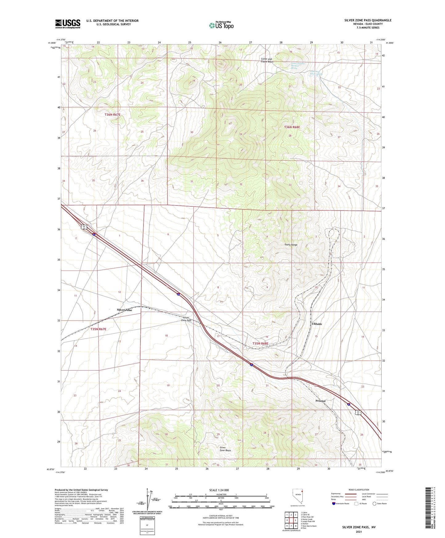
2021 topographic map quadrangle Silver Zone Pass in the state of Nevada. Scale: 1:24000. Based on the newly updated USGS 7.5' US Topo map series, this map is in the following counties: Elko. The map contains contour data, water features, and other items you are used to seeing on USGS maps, but also has updated roads and other features. This is the next generation of topographic maps. Printed on high-quality waterproof paper with UV fade-resistant inks.
Quads adjacent to this one:
West: Hardy Creek
Northwest: Cobre
North: Cobre SE
Northeast: Pilot Peak SW
East: Leppy Peak NW
Southeast: Pilot
South: West Morris Basin
Southwest: Shafter
This map covers the same area as the classic USGS quad with code o40114h3.
Contains the following named places: Arnold, Clifside, Collar and Elbow Basin, Collar and Elbow Dam, Collar and Elbow Spring, Gath, Iron J Mine, Nick Del Duke Mine, Proctor, Proctor Mining District, Silver Hoard Mine, Silver Zone, Silver Zone Basin, Silver Zone Pass, Silver Zone Post Office, Silver Zone Well, The Loop, Toano Number Thirteen Spring