MyTopo
Star Creek Ranch Nevada US Topo Map
Couldn't load pickup availability
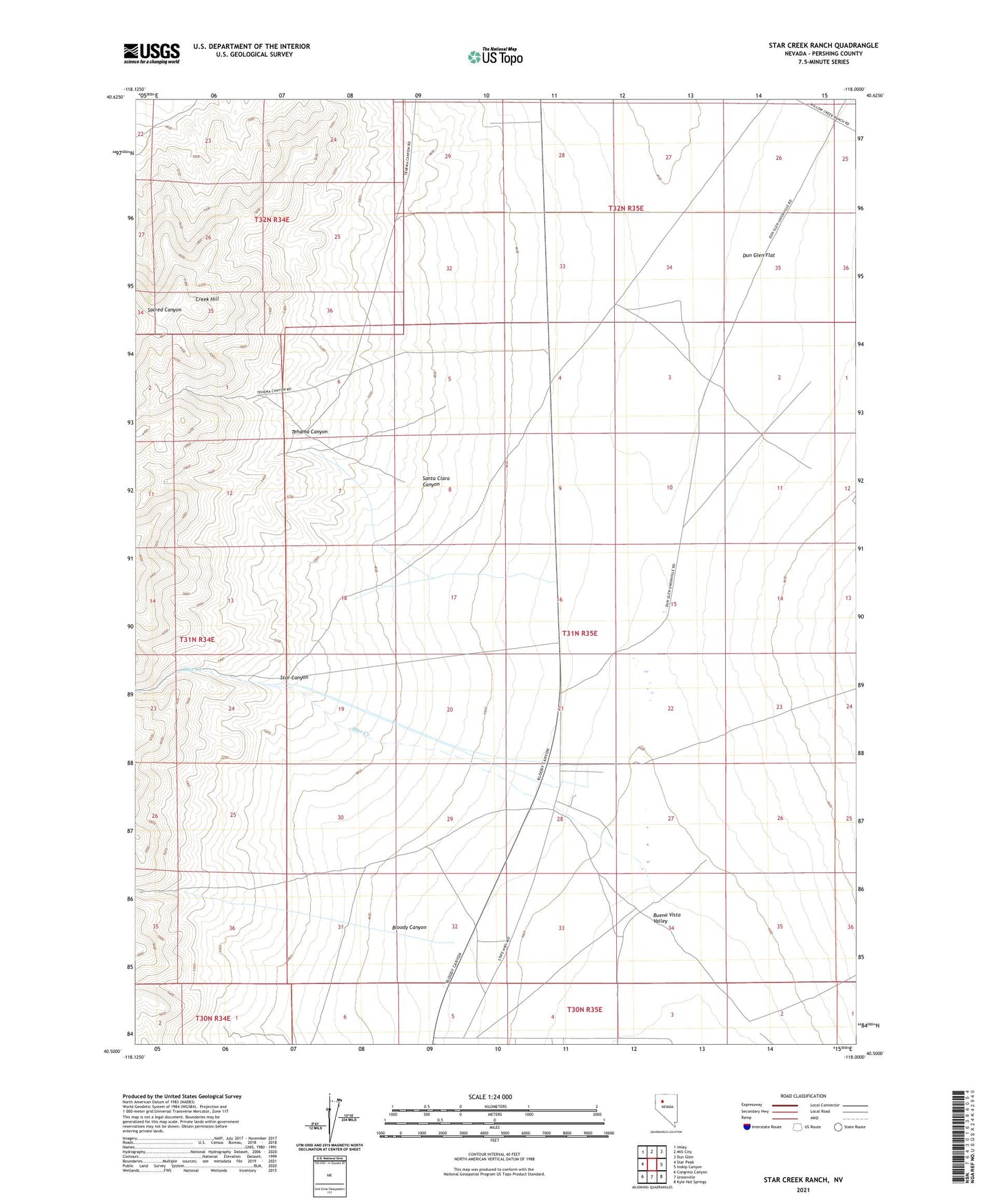
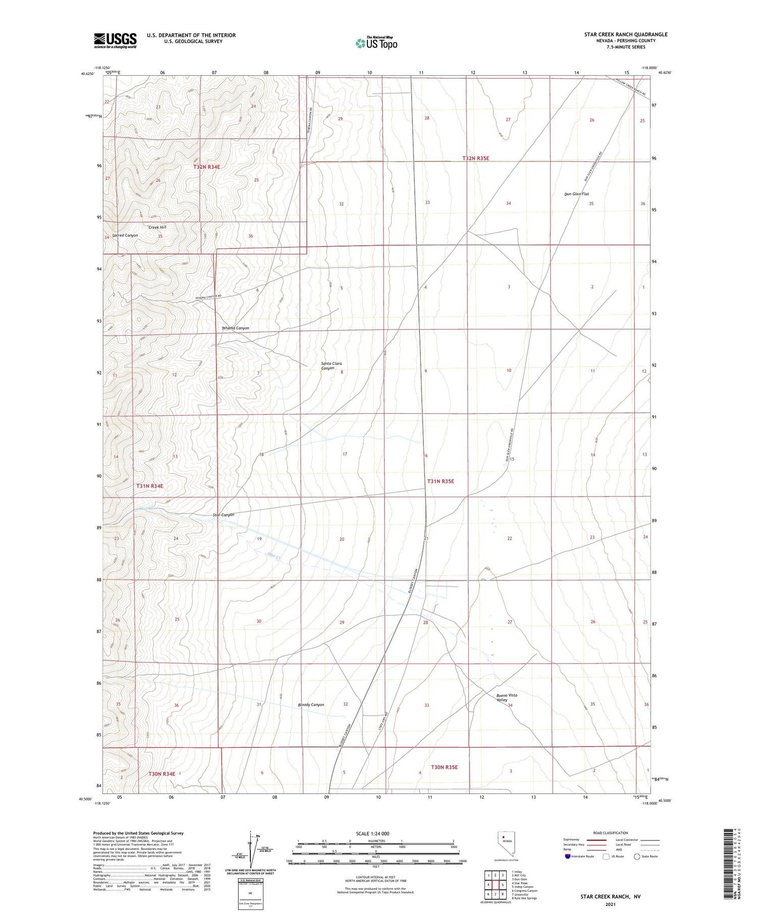
2021 topographic map quadrangle Star Creek Ranch in the state of Nevada. Scale: 1:24000. Based on the newly updated USGS 7.5' US Topo map series, this map is in the following counties: Pershing. The map contains contour data, water features, and other items you are used to seeing on USGS maps, but also has updated roads and other features. This is the next generation of topographic maps. Printed on high-quality waterproof paper with UV fade-resistant inks.
Quads adjacent to this one:
West: Star Peak
Northwest: Imlay
North: Mill City
Northeast: Dun Glen
East: Inskip Canyon
Southeast: Kyle Hot Springs
South: Unionville
Southwest: Congress Canyon
Contains the following named places: Bloody Canyon, Creek Hill, Santa Clara, Santa Clara Canyon, Sheba Mill, Star Canyon, Star Creek, Star Creek Ranch, Star Mining District, Tehama Canyon, Tehama Mine, ZIP Code: 89418