MyTopo
Imlay Nevada US Topo Map
Couldn't load pickup availability
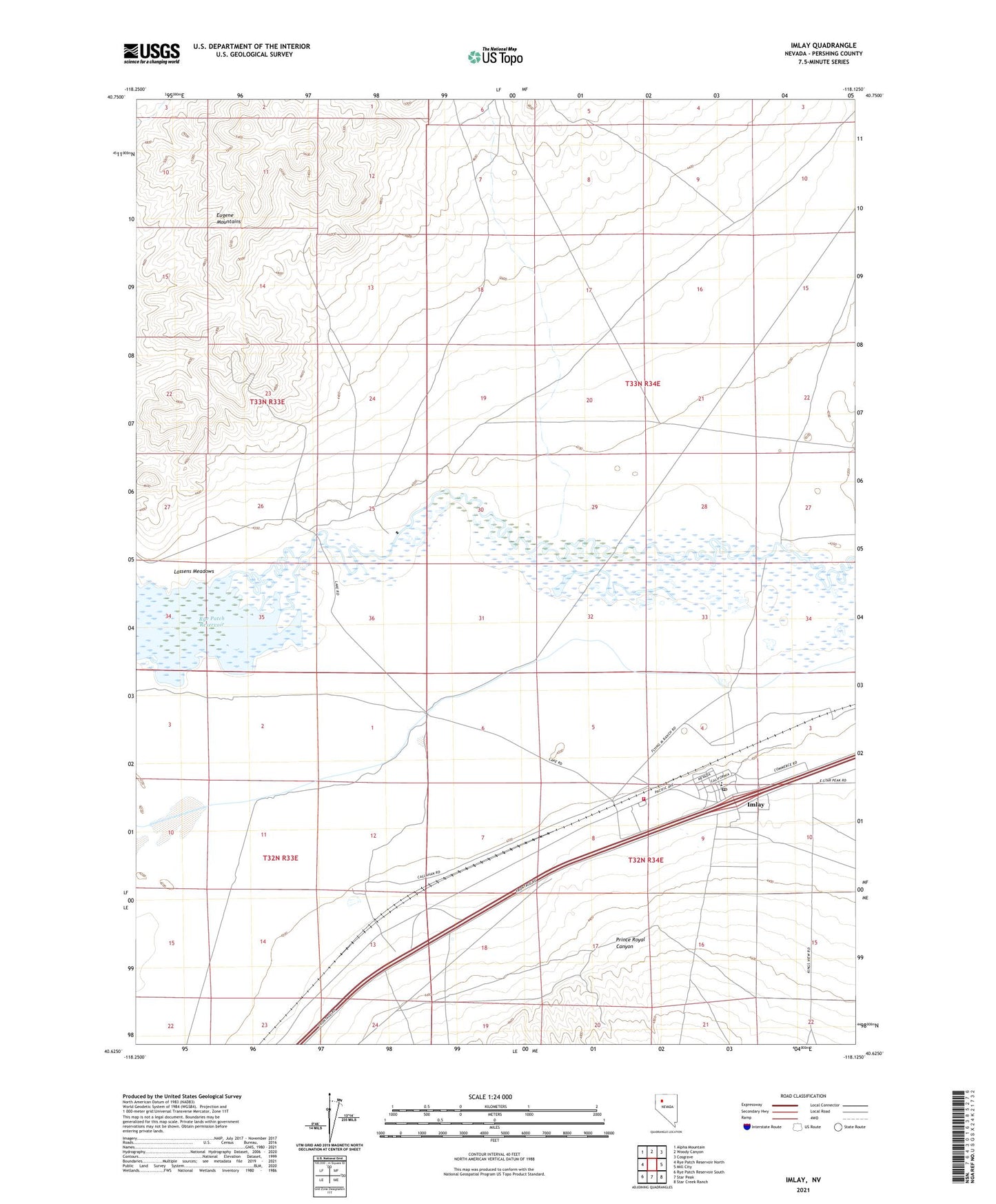
2021 topographic map quadrangle Imlay in the state of Nevada. Scale: 1:24000. Based on the newly updated USGS 7.5' US Topo map series, this map is in the following counties: Pershing. The map contains contour data, water features, and other items you are used to seeing on USGS maps, but also has updated roads and other features. This is the next generation of topographic maps. Printed on high-quality waterproof paper with UV fade-resistant inks.
Quads adjacent to this one:
West: Rye Patch Reservoir North
Northwest: Alpha Mountain
North: Woody Canyon
Northeast: Cosgrave
East: Mill City
Southeast: Star Creek Ranch
South: Star Peak
Southwest: Rye Patch Reservoir South
This map covers the same area as the classic USGS quad with code o40118f2.
Contains the following named places: Barbee Mining District, C and M Ranch, Callahan Bridge, Flying M Ranch, Imlay, Imlay Census Designated Place, Imlay Elementary School, Imlay Post Office, Imlay Volunteer Fire Department, Lander City, Lander Creek, Pitt-Taylor Diversion Canal, Prince Royal Canyon, Saint Marys, Temple Group Mines, Thackers Ranch