MyTopo
Washoe City Nevada US Topo Map
Couldn't load pickup availability
Also explore the Washoe City Forest Service Topo of this same quad for updated USFS data
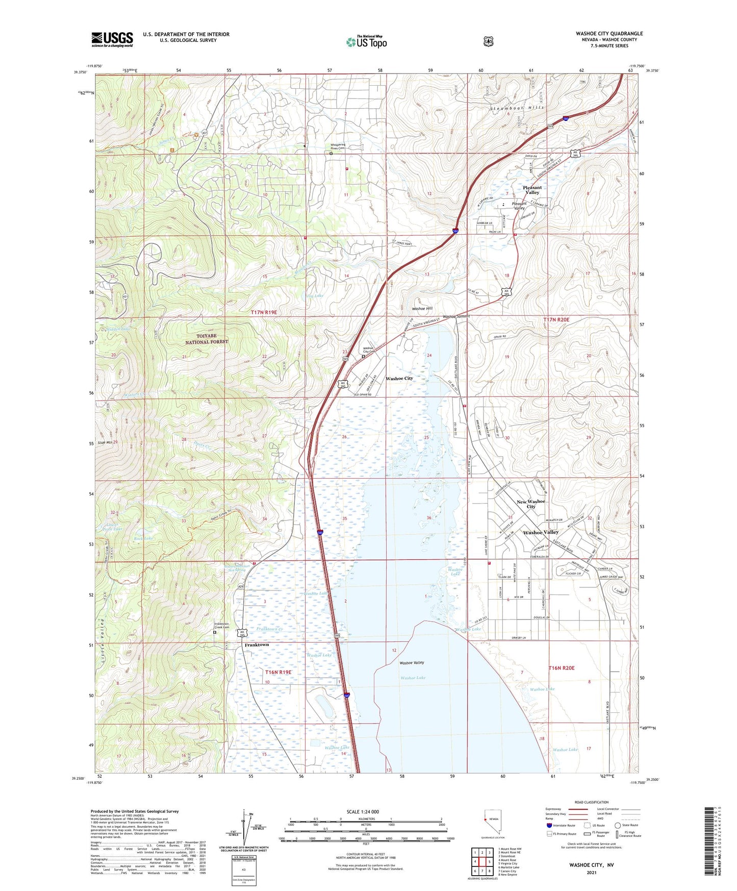
2021 topographic map quadrangle Washoe City in the state of Nevada. Scale: 1:24000. Based on the newly updated USGS 7.5' US Topo map series, this map is in the following counties: Washoe. The map contains contour data, water features, and other items you are used to seeing on USGS maps, but also has updated roads and other features. This is the next generation of topographic maps. Printed on high-quality waterproof paper with UV fade-resistant inks.
Quads adjacent to this one:
West: Mount Rose
Northwest: Mount Rose NW
North: Mount Rose NE
Northeast: Steamboat
East: Virginia City
Southeast: New Empire
South: Carson City
Southwest: Marlette Lake
This map covers the same area as the classic USGS quad with code o39119c7.
Contains the following named places: Atchison Mill, Bailey Ranch Airport, Bowers Fire Control Station, Bowers Mansion, Bowers Mansion County Park, Bowers Mansion Hot Spring, Boy Scout Camp, Browns Creek, Buckeye Mill, Callahan Ranch, Camp Fire Girls Camp, Commonwelth Station, Davis Creek, Davis Creek County Park, Dows Quartz Mill, East Lakes Interagency Fire Center, Flying M E Ranch, Franktown, Franktown Creek, Franktown Creek Cemetery, Franktown Post Office, Galena, Galena Creek, Galena Creek County Park, Galena Creek Fire Station, Galena Creek Guard Station, Galena Creek School, Galena Hill Mine, Galena Mining District, Grass Lake, Hidden Lake, Jones Creek, Joy Lake, KKMR-FM (Sparks), Little Valley, Little Valley Mining District, Little Washoe Lake, Lower Price Lake, Manhattan Mill, Minnesota Mill, Napa Mill, Nevada Division of Forestry Western Region 1 Headquarters, New Beginnings Child Development Center, New Washoe City, New York Mill, Norths Mill, Ophir City, Ophir Creek, Ophir Mill Historical Marker, Ophir Mill Site, Ophir Post Office, Pleasant Valley, Pleasant Valley Elementary School, Pleasant Valley Volunteer Fire Department 37, Pleasant Valley Volunteer Fire Department Station 237, Reno Fire Department Station 16, Rock Lake, Rocky Hill Mine, Scripps State Wildlife Management Area, Sierra Fire Protection District Station 30, Sierra Fire Protection District Station 39, Sierra Fire Protection District Station 82 - Galena, Sky Tavern Ski Area, Slide Mountain Ski Area, Steamboat Hills, Steen Ranch, Stockhams Saw Mill, Sundown Town, Temelic Mill, Union Mine, Washoe City, Washoe Hill, Washoe Lake, Washoe Lake Boat Landing, Washoe Post Office, Washoe Summit, Washoe Valley, Washoe Valley Census Designated Place, Washoe Valley Division, Washoe Valley Reduction Works, Whispering Pines Cemetery, Winters Creek, ZIP Code: 89704