MyTopo
Stillwater Nevada US Topo Map
Couldn't load pickup availability
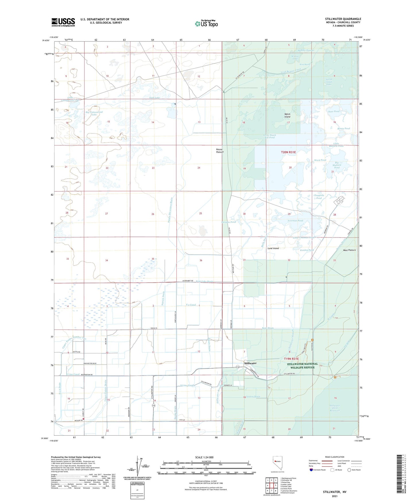
2021 topographic map quadrangle Stillwater in the state of Nevada. Scale: 1:24000. Based on the newly updated USGS 7.5' US Topo map series, this map is in the following counties: Churchill. The map contains contour data, water features, and other items you are used to seeing on USGS maps, but also has updated roads and other features. This is the next generation of topographic maps. Printed on high-quality waterproof paper with UV fade-resistant inks.
Quads adjacent to this one:
West: Indian Lakes
Northwest: Battleground Point
North: Stillwater NE
Northeast: Pintail Bay
East: Foxtail Lake
Southeast: Diamond Canyon
South: Lahontan Mountains
Southwest: Grimes Point
Contains the following named places: Baily Drain, Big Cottonwood Lake, Big Mallard Pond, Boney Pond, Canvasback Gun Club, Cardinal Pond, Chappelle Pond, Dutch Bill Lake, East Lake, East Lake Well, Fallon Indian Sub-Agency, Fallon Paiute - Shoshone Tribe Volunteer Fire Department, Fallon Paiute-Shoshone Reservation, Freeman Pond, Freeman Ranch, Kent Drain, Kent Lake Drain, Kent Ranch, Kerman Pond, Kirkley Pond, Lead Bypass Canal, Lead Lake, Little Cottonwood Lake, Little Dutch Bill Pond, Little Freeman Pond, Little Mallard Pond, Lund Island, North Lead Lake, Norton Drain, Paiute Diversion Drain, Paiute Drain, Paiute Pasture, Patrick Drain, S 2 Canal, S 5 A Drain, Salt Well, Sans Pond, South Lead Lake Landing, Spragia Pond, Stillwater, Stillwater Maintenance Park, Stillwater Point Reservoir, Stillwater Post Office, Stillwater School, Stillwater Slough, Stillwater Slough Cutoff, Sullivan Pond, Swope Drain, Upper Paiute Number Two, Ward Pond, Welch Island