MyTopo
Indian Lakes Nevada US Topo Map
Couldn't load pickup availability
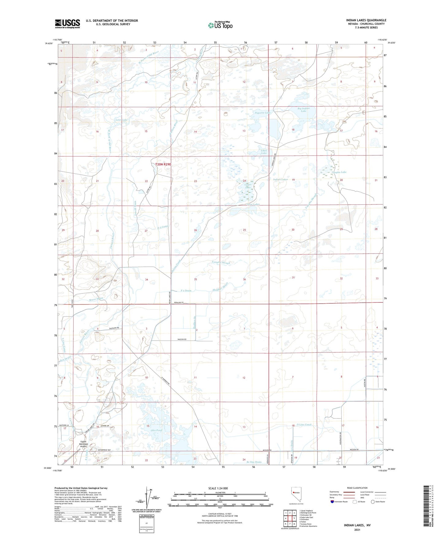
2021 topographic map quadrangle Indian Lakes in the state of Nevada. Scale: 1:24000. Based on the newly updated USGS 7.5' US Topo map series, this map is in the following counties: Churchill. The map contains contour data, water features, and other items you are used to seeing on USGS maps, but also has updated roads and other features. This is the next generation of topographic maps. Printed on high-quality waterproof paper with UV fade-resistant inks.
Quads adjacent to this one:
West: Soda Lake East
Northwest: Upsal Hogback
North: Battleground Point
Northeast: Stillwater NE
East: Stillwater
Southeast: Lahontan Mountains
South: Grimes Point
Southwest: Fallon
This map covers the same area as the classic USGS quad with code o39118e6.
Contains the following named places: Big Indian Lake, Branch One Drain, D 3 Canal, D Line Canal, F 2 Drain, Indian Lakes, John Gallio ranch, Leter Lake, Likes Lake, Mussi Drain, O Line Canal, Old River Reservoir, Oles Pond, Papoose Lake, S 5 Canal, Sagouspe Dam, Shaffner Branch, Shaffner Drain, Twin Lakes, Upper Lake, Upper Paiute Drain, Vaughn Lake, Vaughn Slough, Vencill Drain, Wolf Dam