
MyTopo
Mount Ferguson Nevada US Topo Map
Couldn't load pickup availability
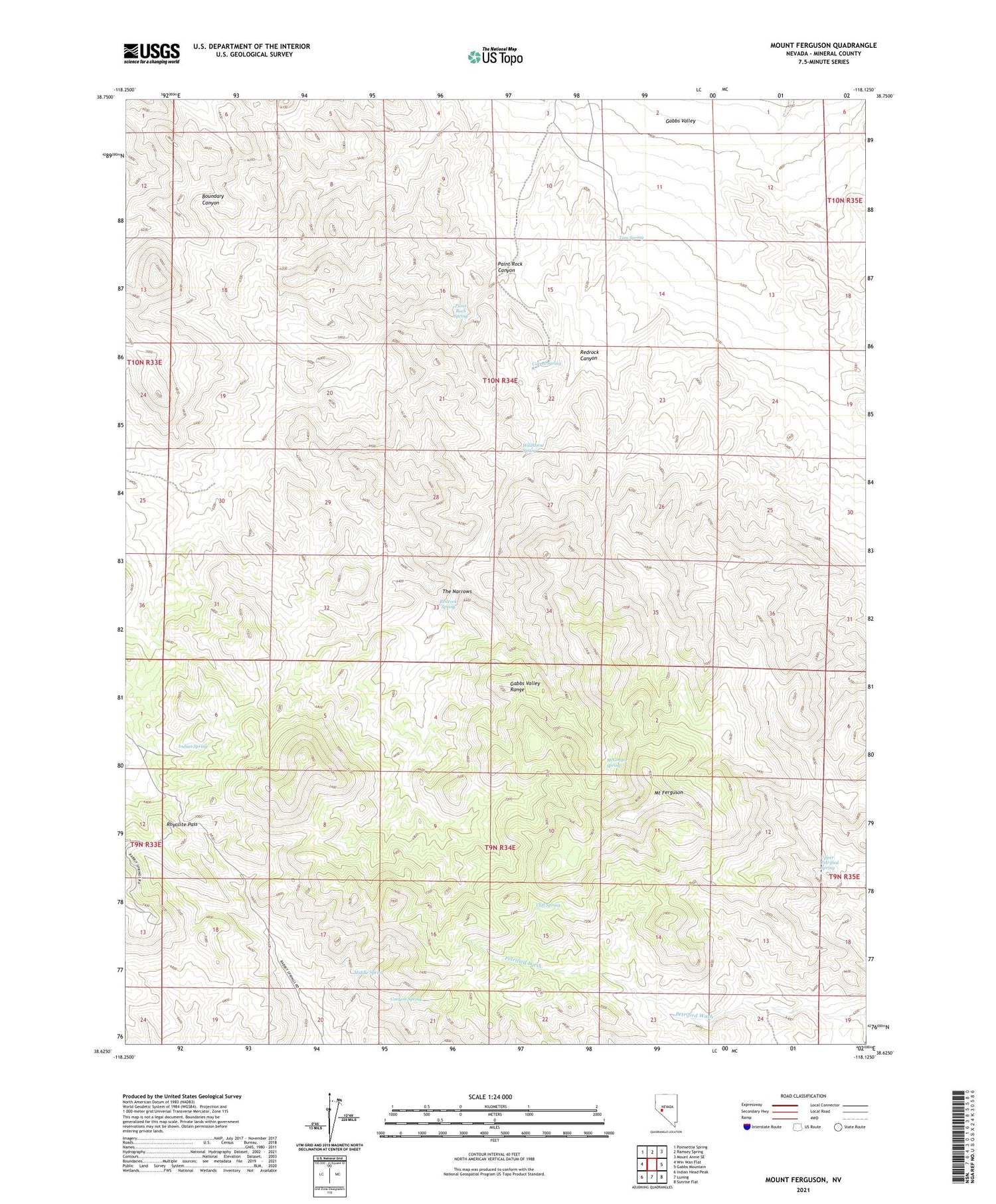
2021 topographic map quadrangle Mount Ferguson in the state of Nevada. Scale: 1:24000. Based on the newly updated USGS 7.5' US Topo map series, this map is in the following counties: Mineral. The map contains contour data, water features, and other items you are used to seeing on USGS maps, but also has updated roads and other features. This is the next generation of topographic maps. Printed on high-quality waterproof paper with UV fade-resistant inks.
Quads adjacent to this one:
West: Win Wan Flat
Northwest: Poinsettia Spring
North: Ramsey Spring
Northeast: Mount Annie SE
East: Gabbs Mountain
Southeast: Sunrise Flat
South: Luning
Southwest: Indian Head Peak
This map covers the same area as the classic USGS quad with code o38118f2.
Contains the following named places: Canyon Spring, Cliff Spring, Corral Spring, Gabbs Valley Range, Indian Spring, McGregor Spring, Middle Spring, Mount Ferguson, Paint Rock Canyon, Paint Rock Spring, Redrock Canyon, Redrock Spring, Rhyolite Pass, Silver Chief Mine, The Narrows, Tom Spring, Upper Petrified Spring, Wildhorse Spring


