MyTopo
Telegraph Canyon Nevada US Topo Map
Couldn't load pickup availability
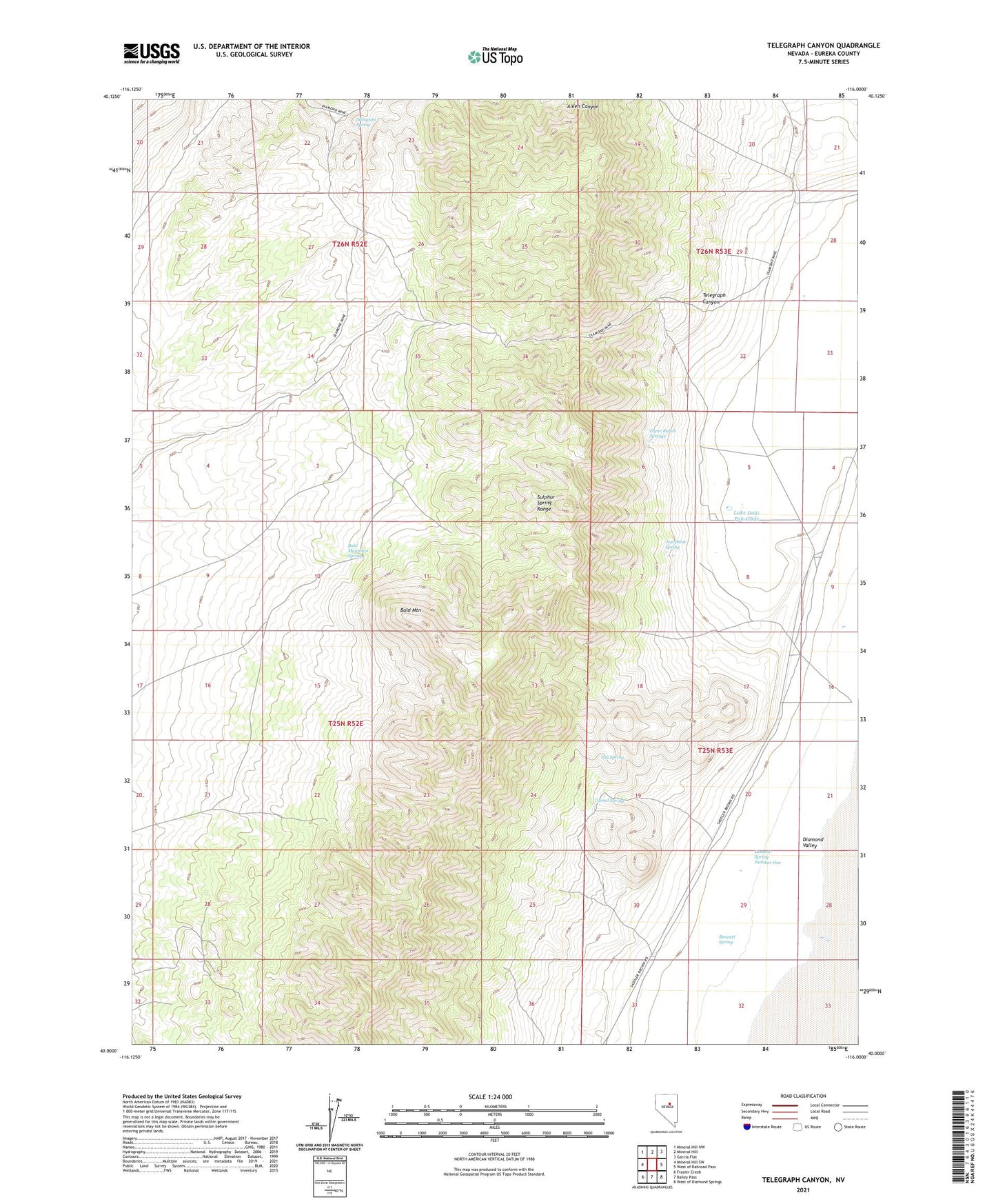
2021 topographic map quadrangle Telegraph Canyon in the state of Nevada. Scale: 1:24000. Based on the newly updated USGS 7.5' US Topo map series, this map is in the following counties: Eureka. The map contains contour data, water features, and other items you are used to seeing on USGS maps, but also has updated roads and other features. This is the next generation of topographic maps. Printed on high-quality waterproof paper with UV fade-resistant inks.
Quads adjacent to this one:
West: Mineral Hill SW
Northwest: Mineral Hill NW
North: Mineral Hill
Northeast: Garcia Flat
East: West of Railroad Pass
Southeast: West of Diamond Springs
South: Bailey Pass
Southwest: Frazier Creek
This map covers the same area as the classic USGS quad with code o40116a1.
Contains the following named places: Bald Mountain, Bald Mountain Spring, Bald Mountain Well, Bear Mine, Bennett Spring, Bennett Spring Number One, Fera Well, Flynn Ranch, Flynn Ranch Springs, Josephine Spring, Lake Dou-Pah-Gade, Old Whalen Mine, Ryepatch Well, Siri Spring, Stimpson Spring, Telegraph Canyon, Tunnel Spring