MyTopo
Owyhee Nevada US Topo Map
Couldn't load pickup availability
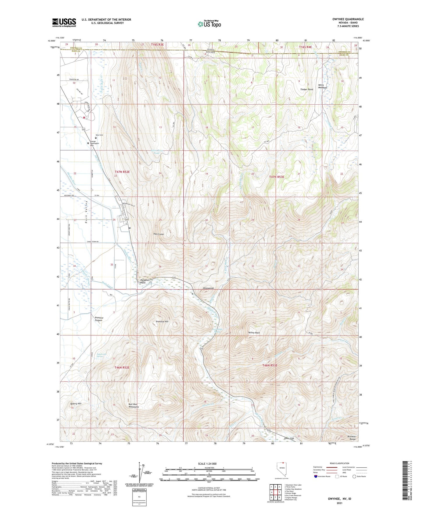
2021 topographic map quadrangle Owyhee in the states of Nevada, Idaho. Scale: 1:24000. Based on the newly updated USGS 7.5' US Topo map series, this map is in the following counties: Elko, Owyhee. The map contains contour data, water features, and other items you are used to seeing on USGS maps, but also has updated roads and other features. This is the next generation of topographic maps. Printed on high-quality waterproof paper with UV fade-resistant inks.
Quads adjacent to this one:
West: The Point
Northwest: Mountain View Lake
North: Three Forks
Northeast: Indian Hay Meadows
East: Winter Ridge
Southeast: Mountain City
South: Ungina Wongo
Southwest: Dry Creek Reservoir
This map covers the same area as the classic USGS quad with code o41116h1.
Contains the following named places: Agency Canal, Bahm Basa Pond, Cavanaugh Spring, China Dam, Cleveland Trail, Cow Creek, East Fork Skull Creek, Fawn Creek, George Washington Cemetery, Great Basin College Owyhee Satellite Center, Jones Flat, Main Canal, New Cemetery, North Fork Skull Creek, Ottawanah, Owyhee, Owyhee Combined School, Owyhee Community Health Facility, Owyhee Elementary School, Owyhee Post Office, Paradise Point, Prentice Canyon, Prentice Hill, Quarry Hill, Reed Creek, Sagebrush Spring, Shoshone - Paiute Tribes Fire Station, Skull Creek, South Fork Boyle Creek, Summit Creek, The Crater, Timber Point, Willis Meadows, Yellow Rock